A cold front moved into the Central Coast region today, driving down temperatures and kicking up the winds.
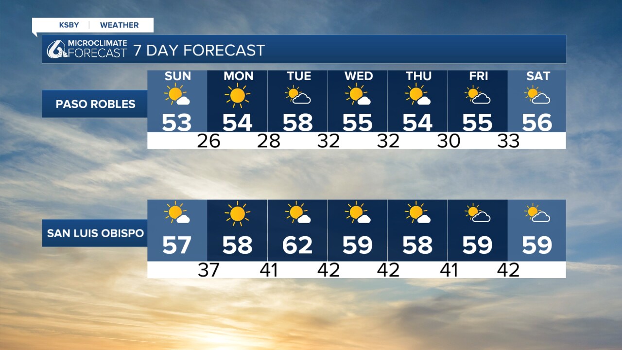
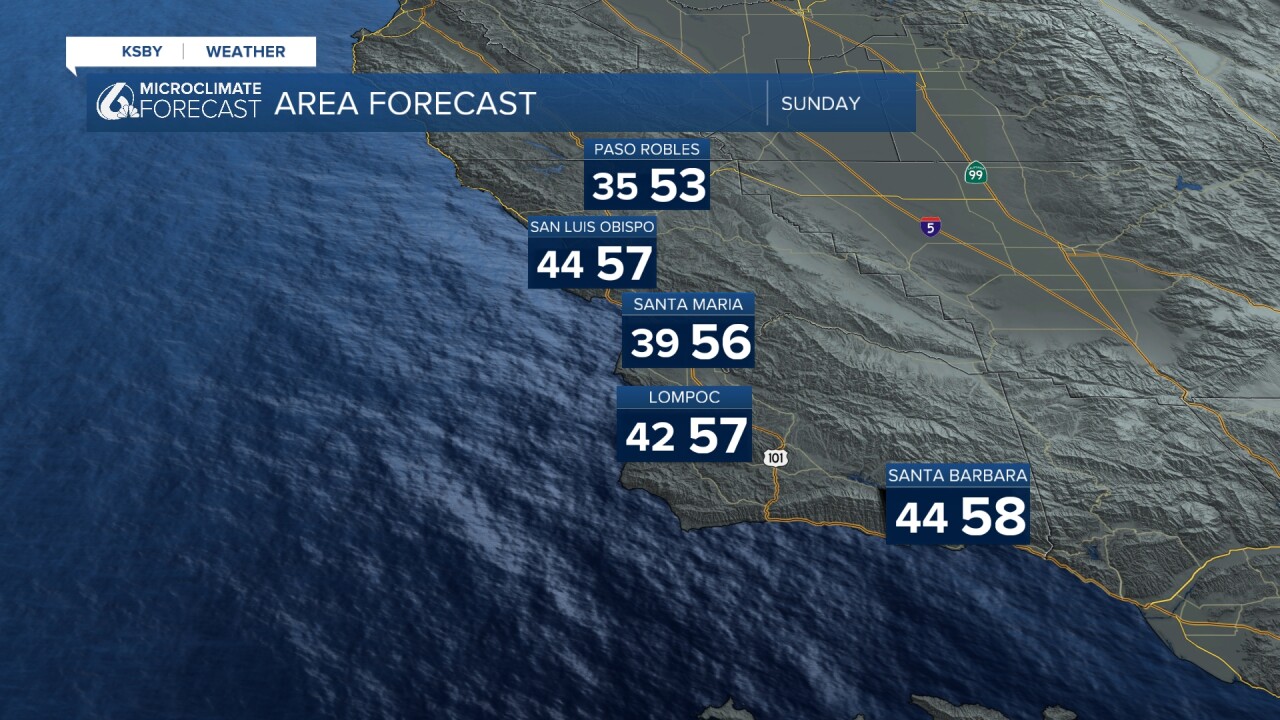
There shouldn’t be much rain with the system but temps will be noticeably cooler tonight and tomorrow with average temps along interiors, valleys and beaches in the 50s and wind speeds averaging around 15 mph throughout the Central Coast.


A high wind advisory will kick into effect for the Central Coast from 7 p.m. tonight until 7 p.m. tomorrow.
Another area of concern is the Santa Barbara County mountains and Southeast region, where there is a high wind warning, with gusts around 60-70 mph.
A high surf warning is in effect until 9 a.m. Monday and large waves with heights ranging from 15-20 ft are expected near the beaches. Minor coastal flooding is possible during morning high tides.
Also of note - along the interiors, a hard freeze watch will go into effect Sunday evening until Monday morning.