
The storm system we've been talking about for a week is finally here. Showers are already falling as of late afternoon on the San Luis Obispo County North Coast.
The rest of the area will get in on light to moderate rainfall in the evening hours with rain continuing into Saturday morning. The Storm Prediction Center now includes coastal California with a slight risk of thunderstorms into Saturday.
A brief lull in activity is likely from Saturday morning into the afternoon before more consistent rainfall returns. I don't expect the lull to be perfectly quiet — some scattered showers are possible.
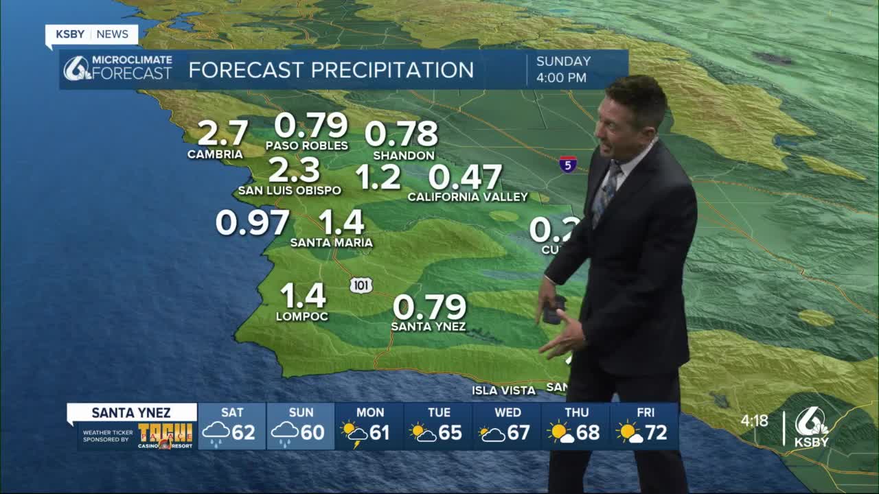
Later Saturday afternoon into Sunday morning the second part of a three-part rain event should continue to soak the Central Coast. Through Sunday afternoon, rainfall totals should range from lighter amounts in the deep interior to as much as 3 inches along the San Luis Obispo County North Coast. Most locations should have somewhere between 3/4 of an inch to 1.5 inches of rain. And again, this is not the entirety of the event.
Late Sunday or early Monday into late Monday looks to be the last push of this rain event. Like the beginning event, the Storm Prediction Center has identified the area as having a risk of thunderstorms.
While the risk is considered slight, it can produce rainfall rates between a quarter or 2.5 inches per hour.
This last push of moisture will have to be watched carefully because it is likely we will have some level of saturation before moderate rainfall. Flooding is possible during this four-day event.
The only active advisories are for high surf with the Central Coast having a surf advisory that begins at 3 a.m. Saturday, lasting until Sunday at 9 a.m. for 10-to-14-foot breakers along the west-facing Central Coast.
There is also a surf advisory for the South Coast and Santa Barbara County during the same time frame for 5-to-8 foot breaking waves.
Other advisories may get posted during this event and the best way to follow that is with the KSBY microclimate weather app. Please turn on your notifications so you will become aware of when and if new advisories affect your area.
By Tuesday, the last storm system will have moved on and temperatures will begin to warm. By the end of next week, temperatures will have returned to the upper 60s to low 70s for the Central Coast.
