
The Central Coast will continue to experience mild temperatures over the next few days, accompanied by overnight to morning patchy low clouds and fog. However, gusty Sundowner winds are expected during the evening and overnight hours along the Santa Barbara Southwestern Coast and the adjacent Santa Ynez range, raising concerns for elevated fire weather. A warming trend is anticipated to begin on Sunday as high-pressure returns to the region.
Current Conditions and Winds
The onshore gradient across the Central Coast is lower than it was yesterday, with the Santa Barbara Southwestern Coast experiencing compressional warming due to offshore Sundowner winds. This warming effect is expected to persist, though Saturday will likely see only slight variations in temperatures. A small warming trend is most probable for coastal and valley areas due to weaker onshore flow.
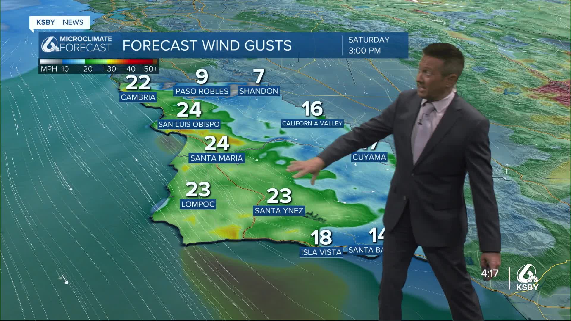
I am again watching Sundowner winds that may reach advisory levels tonight, starting between 3 PM and 6 PM and continuing through around 6 AM. A Wind Advisory may be issued with strong winds at ridgetops and through canyon passes. These conditions will create elevated to brief-critical fire weather concerns near the Refugio Fire, despite high humidity levels maintained by the marine layer.
Weekend Warming and Outlook
As the low-pressure system moves eastward on Sunday, high pressure is expected to rebuild over the region. Morning surface pressure gradients are likely to become near-neutral to offshore, keeping skies clear and potentially driving gusty northerly-to-northeasterly winds in interior areas overnight into the morning.
Temperatures are forecasted to rise by 3 to 6 degrees across the region, and if offshore winds continue to develop favorably, highs for coastal and valley areas may be adjusted upward.
High pressure will continue to strengthen over the Central Coast, with Sunday marking the start of a warming trend that will peak on Monday and Tuesday. While there is high confidence that these will be the warmest days of the forecast period, there is moderate confidence that temperatures will remain below heat advisory levels. Weak offshore pressure gradients are expected to persist through Monday and Tuesday, which will keep cloud coverage minimal. By Wednesday, onshore gradients are likely to return, initiating a cooling trend.
Looking Ahead: Monsoonal Moisture
There remains a small chance of monsoonal moisture reaching the Central Coast by mid-next week. While the impact is uncertain, it is something to monitor as the forecast develops. Stay tuned for updates on potential weather changes in the coming days.
