


Good morning, Central Coast!
Yesterday brought rain, winds and waves across the region. Today the rain fades into the rear view but winds and waves continue.
Here is a look at the rain totals for our region.
With the system moving south the headline is now gusty winds in the Santa Barbara County mountains and along the the South Coast.

Strong winds from the north will bring sustained winds 25 to 35 mph as well as gusts up to 45 mph on the South Coast and up to 65 mph in the passes peaks and canyons of the Santa Barbara county mountains.

Alongside the winds waves continue to be a concern. All of our beaches are under a high surf advisory. For the south coast this is only through Thursday afternoon but for the west facing beaches the story is much different. That will be in place through Monday.
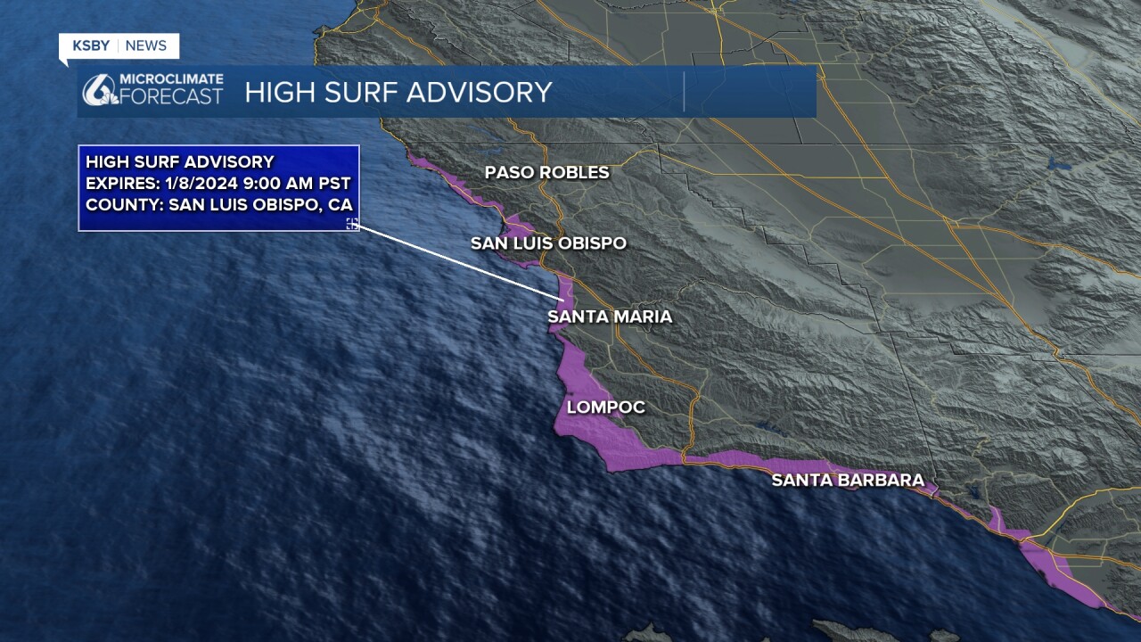
The wave story is different for the Central Coast because the surf advisory currently in place for 10 to 15-foot waves we'll continue into Monday as waves are expected to increase to 12 to 18 feet on Friday. Elevated surf is likely into early Monday morning and that high surf advisory expires at 9:00 AM Monday. Dangerous rip currents are the key concern but also activity near jetties. People should be aware of the elevated surf and avoid proximity to it.

These waves will not be as large as the wave event last week which coincided with high tides to produce high surf warnings and coastal flood warnings. There is no coastal flood advisory currently in place for this event.
Temps today are a bit on the cool side although they are close to normal for this time of year, 50s and low 60s by the beaches with 50s and upper 40s in the interiors.
The forecast looks fairly quiet with mostly sunny skies through the week.
This weekend though a storm will push through the west coast and bring us a fleeting chance of rain overnight Saturday into Sunday. It could produce a few showers but they are unlikely during the daytime hours on Saturday or Sunday so it wouldn't show up as an icon on a 7-day forecast.
Beyond that, a system around the midpoint of next week is still looking likely for more rainfall and lower snow levels.
Have a wonderful day Central Coast!
