

Good morning Central Coast!
Happy Fourth of July! Here is a look at your festive forecast!
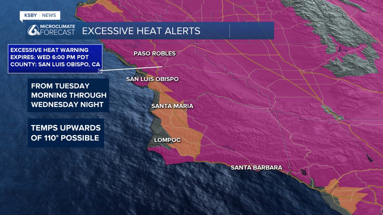
High heat is expected for interiors climbing towards record highs today near 110°, coastal valleys will be into the upper 80s while beaches will be on the cool side thanks to significant cloud cover and marine influence.

Alerts for the heat have once again been extended, this time through Wednesday of next week. These are the same warnings and advisories that we have faced for days at this point. Residents are advised to stay hydrated, avoid outdoor activities during peak heat hours, and check on vulnerable populations. Stay tuned to local updates for further information and safety guidelines.
Beaches are facing significant fog, that will keep them cool but may cause concern for firework displays tonight. The low clouds will be VERY low and dense where it is July 4th evening. Models struggle to model stratus THIS low, but this model likes quite a bit of a cloud deck right at the beach line. It does show a small possible donut of clearing around Pismo at 9 p.m. but this may just be wishful thinking. I think the stronger message here is that the low clouds will be near, and we'll be lucky to get clearing when and where we'd like it.
ALL communities have increased fire weather risk (warnings in some cases) take extreme caution with fireworks or anything that could cause vegetation to spark. The combination of extreme heat, low humidity, and potential sundowner winds raises the risk of fire hazards. Residents are urged to stay informed about fire weather updates and take necessary precautions. Leave the fireworks to the professionals.
Tonight and through the forecast, nighttime conditions will become more of an issue. Overnight lows will be uncomfortably warm, especially in elevated areas (1000 to 3000 feet), with temperatures in the mid to upper 70s and some areas not dropping below the lower 80s.
Turning away from the 4th into the extended forecast. Friday will once again feature highs climbing past 110°, coasts will also start to heat up with highs climbing into the upper 90s even in coastal valleys. This will make for the hottest day of the week for most communities likely reaching record highs.


For the weekend into next week, the hot temps are here to stay as the high pressure that is driving this pattern fails to dissipate. Slight relief may come with increased onshore flow, bringing some cooling to coastal valley areas. Inland areas will continue to experience very high temperatures, and heat warnings may be extended.
Have a great day Central Coast!
