


Good morning Central Coast!
We have made it to the midpoint of the week and it looks like a great day ahead! To start off skies are clear and for the most part winds are calm. There is a few patchy areas of fog along our south coast but that will be minimal.
As the day goes on temps will raise and clear out any lingering marine fog.
The combination of clear skies and limited offshore winds in the interiors will combine to make for a mild day. Beaches will be in the 60s, coastal valleys in the 70s and 80s for the interiors.
Waves are still a concern across all western beaches. Localized sets up to 12 ft are still possible today.

Thanks to the waves the high surf advisory has been extended through 2 p.m. for all western beaches. Take caution.

Winds will pick up this afternoon and will once again bring a sundower wind event to the Gaviota coast. Gusts will peak near 40 mph. That is just a hair shy of the advisory criteria so there are none issued. Regardless of that, take cautions with the winds overnight.
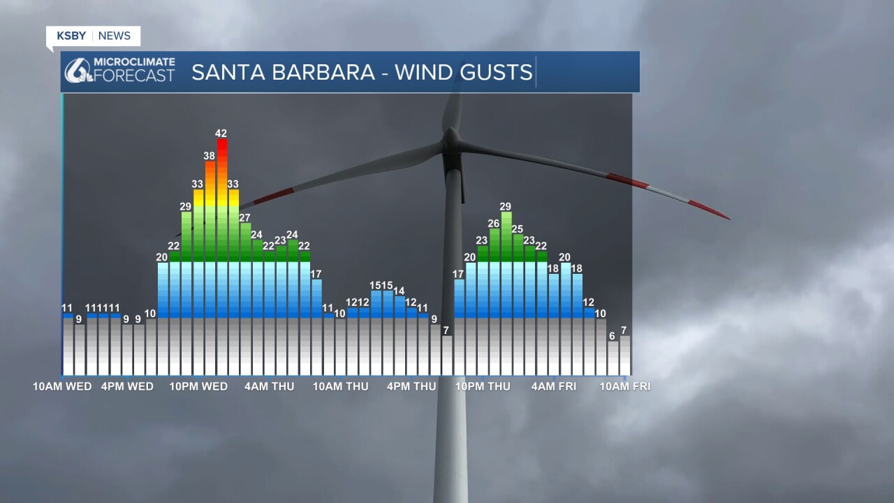
Thursday will be the warmest day, most interiors will push into the mid-80s thanks to building offshore winds. Enjoy the warmth though, Friday temps will fall and clouds will push in as a trough pushes in from the North Pacific. This change will first bring marine layer fog Friday but that will soon be replaced by a very small chance for rain early Saturday morning.
Maximum accumulations are in the hundredths of an inch. No big concern for the events going on this weekend but it is still something to be aware of.
Next week temps will recover a touch but not substantially.
Have a great day Central Coast!
