

Good morning, Central Coast!
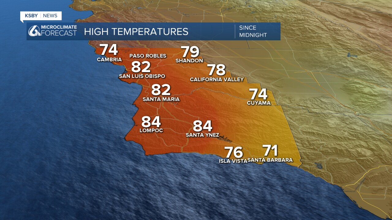
Thursday was a hot one across the region, with temps soaring 20 degrees above normal for this time of the year. That, paired with sunshine and strong offshore winds, made for a summer-like feel as soon as the morning fog cleared out. Here is a look at the high temps from Thursday across the region.
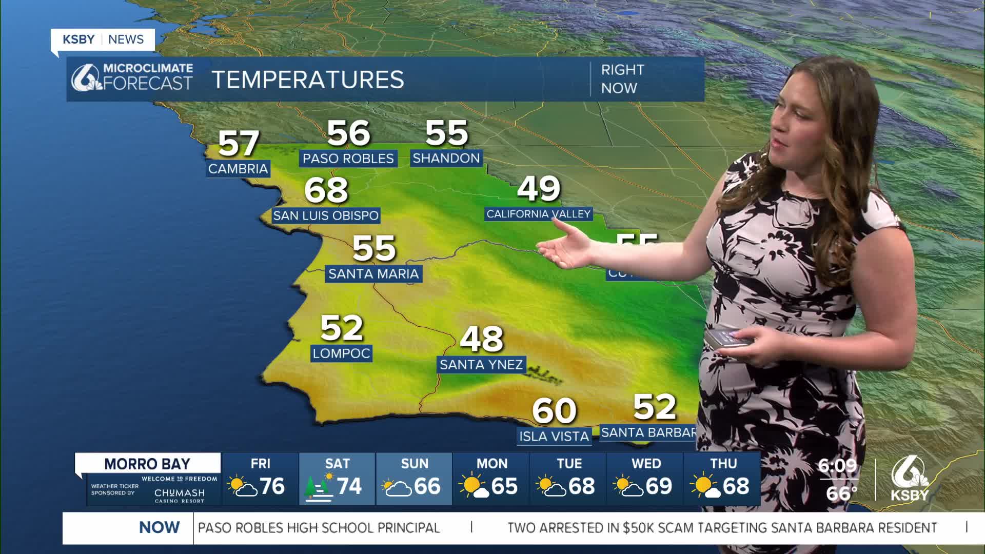
Today will be even warmer, and unlike Thursday, it will be much clearer to start off. This warmth is due to several factors working together, one of which is the winds. Strong offshore winds push over the higher elevations and towards sea level. As it traverses that terrain, the air dries out and heats up substantially. By the time it reaches our coastal valleys and the beaches, the air is much warmer.
Here is a look a the winds this morning.
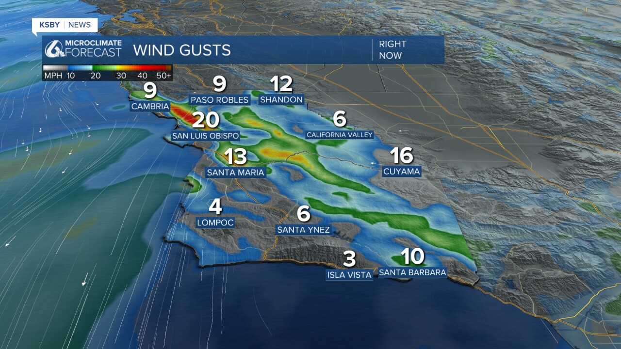
At the highest peaks and for some gusty moments, the winds may be up to 45 mph. That is enough so a high wind advisory has been issued for coastal San Luis Obispo County through 2 p.m. Friday afternoon.
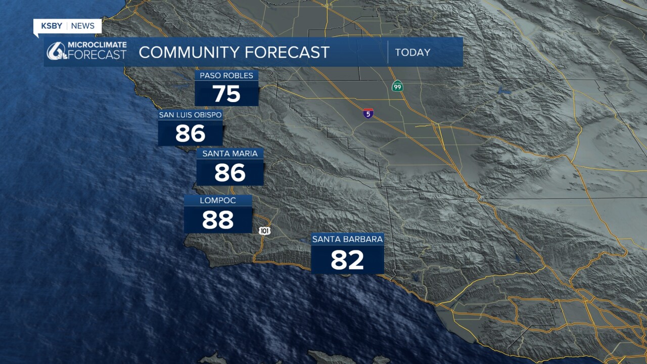
Here is a look at the high temps we can expect today across the Central Coast!
Early Saturday morning, some onshore winds will kick in and bring back fog across most of the region. This will limit morning visibility but will clear out quickly. The addition of this cooler and damper air will cool down daytime temps a bit but we will still stay well above normal for this time of the year.

By the latter half of next week, we will have warmed right back up into the 70s with abundant sunshine.


Even into mid-March, we can still expect sunshine and great weather with limited (more like non-existent) rain chances.
Have a wonderful day and great weekend, Central Coast!
-Vivian
