Good morning Central Coast!
This morning the winds are our headline, causing issues across the west coast and particularly in the mountains of Ventura county.
This event is driven by strong Santa Ana winds, and have prompted many alerts as well as are adding to fire weather concerns. Here is a look at the oncerns associated with the winds.
Extreme #FireWeather conditions continue, with #RedFlag warnings in effect through Fri morning. The Particularly Dangerous Situation has been extended until 3pm today for the San Gabriel & Santa Susana Mountains. #CAwx
— NWS Los Angeles (@NWSLosAngeles) November 7, 2024
Stay alert & follow instruction from emergency officials! pic.twitter.com/kyhWM5T5Go
These winds will continue to be a concern into Friday. At that point winds will calm significantly.
While our winds have been gusty we are just on the edge of this concern and are only seeing winds up to 30 mph. Passes peaks and canyons will face some higher gusts but none above advisory level criteria.
Winds this morning will keep many valley locations on the more mild side (mid 30s) although where winds are calm, some sheltered locations will see much cooler temps. This has prompted a Freeze Warning for the interior valleys through 9 a.m.

It is a good time to bring sensitive plants inside if you haven't already.
Into the day skies will be perfectly clear and temps will warm quickly. Light offshore winds and very dry air will bring highs back into the 70s for most communities with 60s at the beach.

Friday into the weekend winds will calm and a small warming trend will take over. Mid-70s (just above normal) temps are expected into the weekend with some resurgence of morning fog by the beach. Overnight lows will once again fall below freezing in the interior valleys.
Early next week we will see a few weak storms pass to our north. The first of which will bring cooler air, onshore winds, and the chance for a tiny rain chance, that will be barely noticeable.
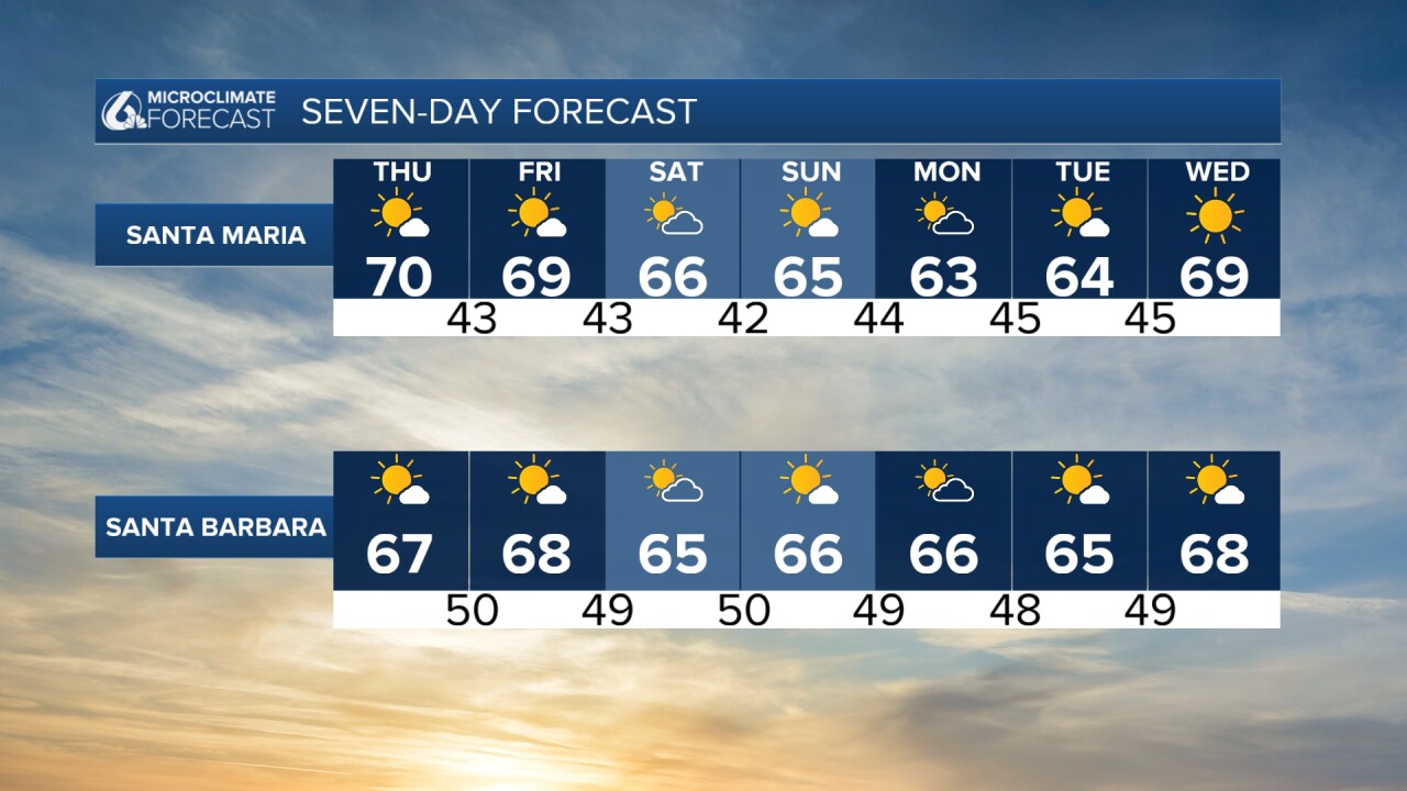
Here is a look at the 7 day forecasts!


Have a great day Central Coast!


