

Good morning Central Coast!
To kick off the morning there is some dense fog in Western Santa Barbara County, particularly for the Santa Ynez Valley where visibility may be problematic. Take it slow on the roads.

The Central Coast led off the week with fairly quiet weather, and today will be very similar.
Today's highs are very consistent, mid 60s for most communities.
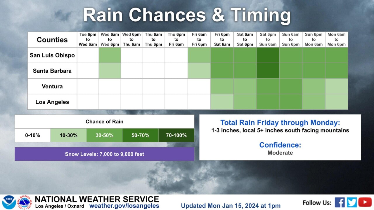
Now let's turn to rain chances. Here is an overview, I'll dive into the details below.
Late tonight into Wednesday morning a cold front will press through the region and bring gusty winds, cooler temps and a few scattered showers.

Accumulation-wise this isn't going to be a big one, most locations will see just a few hundredths of an inch. Northern San Luis Obispo County is expecting a little more with totals between 0.10 and 0.25".

Most of the activity on Wednesday looks to be centered on the morning but a few isolated afternoon showers can't be ruled out as the atmosphere warms and become slightly less stable.
Despite the shower opportunities on Wednesday the temperatures still look very mild with much of the area still seeing highs in the mid-60s.
Once the showers clear a high pressure will build in and bring abundant sunshine and mild temps Thursday and Friday. Take these days to prepare for a bit of a soggy weekend.
Friday night a cold front will press through and bring the start of our rain chances. This first impulse won't be big but it will open the door for a line of storms to last the weekend.

On and off showers will continue through Saturday into Sunday afternoon when a stronger front will press through and bring the chance for heavier rainfall and additional winds. Sunday night into early Monday morning is the period with the most impactful rain.

If you add all that activity up you could see another 3/4 of an inch to two or 2 1/2 inches of rain.

This weekend's storm is still a way out but models are indicating that it will likely be impactful. Take the time to prepare now, not just for this weekend but for a likely active weather pattern as we move into the 8-14 day Climate Prediction Center Forecast.
Have a wonderful day Central Coast!
