

———Update from Meteorologist Vivian Rennie ———
Due to a breaking news report from NBC National following the meeting of President Biden and Chinese President Xi Jinping our midday forecast was cut short, in lieu of tha here is a look at the weather at 11:30 a.m.
———Original Article———
Good morning Central Coast!
We have been chatting about a big change in the forecast with rain on the way for nearly two weeks and the system is finally here so lets dive right in!
This morning is on the mild side with temps consistently in the 50s with cloud cover overspreading the region. To kick off the (very) early morning some showers pushed through the most northern reaches of SLO County but that cleared quickly. More robust showers are beginning to push through the Santa Barbara area for the 6 a.m. hour. While the odds that anyone is reading this as those storms persist is nearly zero it is important as they are very much representative of what we will expect today.
As the low spins offshore and begins to press more rain into the region we need to first overcome the very dry air in place in the interiors. The first few storms will hit that dry air and dissipate quickly. This will not bring much rain to the surface but it will help to prep our atmosphere for later on today.
By mid morning the shower chances will become more robust and scattered light rain is expected to cross the region lasting though the day.
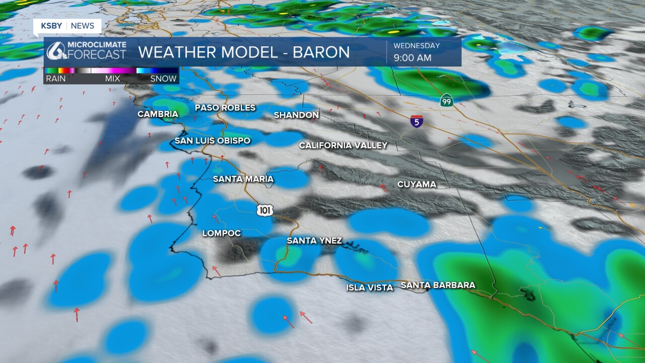
By no means will it rain all day, these are scattered light showers at best. The key to this storm though isnt intensity of rain but longevity of the light rain we will see. There is still a large amount of model disagreement on exactly how much rain we will see. Myself and Dave are sticking with what we have been saying for the past few days. 0.5" to 1" is expected for most communities with some peaks (looking at you Rocky Butte) seeing closer to that 1.5" threshold. The only exception to this is the far interior valleys where I would be surprised if they accumulated even a quarter of an inch.
The National Weather Service adjusted its forecast down this morning fromt heir initial robust 3+" forecast and is now closer to our forecast.
Winds and waves are also a concern today. A Wind Advisory is in place for most of the Central Coast, excluding SLO County interiors through early Thursday morning.

While we’ll get some wind the surf looks to stay under 10ft, so no advisory has been issued.
There are currently no other advisories other than the wind advisory but if the higher end rainfall does take place some rain related advisories are possible.
Just to not miss out on the typical meat of a forecast, it will be a bit cooler today thanks to the rain.
The set-up remains the same. There is a positively tilted trough and a huge area of low pressure off the coast. This low is reluctant to move east until Friday and Saturday. So what rain we get will likely be pieces of energy that shoot off the parent low. It is possible the best dynamics of the system stay off the coast and when they do come east they may weaken producing only moderate rainfall. There is also dud potential, some models show rainfall less than .50”
This is a low end atmospheric river event. All that means is that the system has active moisture transport along with it. It is a 1 on a scale of 5 and only hitting that category on Thursday.
The system will produce on and off rainfall into Saturday before moving on. The holiday week next week looks benign in terms of weather.
Have a wonderful day Central Coast!
