Good morning Central Coast!
Overnight we got our first substantial rain of the season (yay!) Thanks to the storm's very topography-driven nature, the totals vary wildly depending on location. Ridges and peaks (especially in SLO county) saw inches of rain while most communities collected closer to a half inch.
Just as expected the storm fell apart quite quickly as it pushed south. Most of the south coast saw little more than a trace. Either way, though the rain we accumulated will lower fire danger on many of our dry hills.
Moving onto the forecast. Today is going to be a bit of a mixed bag. Cloud cover and some sunshine will be the story. There is still some lingering instability in the atmosphere so some small scattered showers are not out of the question.
Winds will continue to be a bit of a bother with some gusts still up to 35 mph. This is a bit calmer than last night so the previous wind advisory has expired.
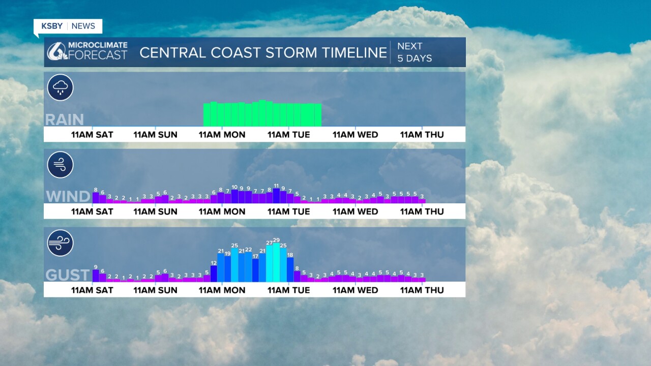
Pressing fast-forward into Sunday, we will see another storm headed our way. This time, it will be from anotherannother low pressure that will take on the features of a small atmospheric river, bringing rain through Monday into Tuesday.

That storm will bring more widespread substantial rain to all of the Central Coast and eventually all of Southern California.
Rain will begin with a small pocket of shower potential early Sunday morning, this is so mall many will not notice it.

The rain will begin in earnest by Sunday evening, again starting in north SLO county and working south.

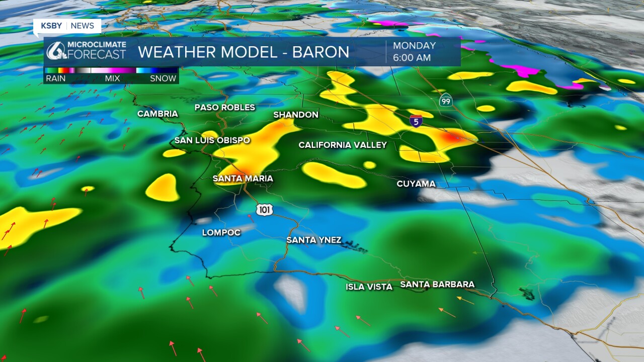
By the start of the Monday morning commute heavy rain will have set up for much of the Central Coast. This could cause some very tricky road conditions, especially before dawn.

Through much of the day the pockets of heavy rain will continue. Eventually, it will break to lighter rain with some lingering wind gusts and the rain pushes south.

Rain totals will be greater than our Friday-Saturday system but thankfully are still well below flooding thresholds across the region. The ridges and peaks of the Santa Lucia and Santa Ynez range mountains will see the most, interior valleys are on the other side of that coin.
Here is a look at the Weather Prediction Center rain accumulations. I think on the whole this is very likely the only change to my forecast is some limiting along the south coast. I think they will be closer to 1.25".

On Tuesday the storm will move south and leave some lingering rain possibilities alongside a bit of a dreary day. Finally, Wednesday will bring some clearing and we will stay cool but dry into late next week.


One note for next weekend, there are a few storm impulses that may take form to shift late next week on the cool and cloudy side. Right now that does not look like it includes rain but the pattern is very progressive and has a lot of room to change.
Have a wonderful weekend Central Coast and be sure to stay weather-aware as we push through the heavier rain expected into next week.


