

——— 11 a.m. update from Meteorologist Vivian Rennie———
New models are in and there is a bit of a shift in the storm (some good news, some bad news). Here is the latest! Late tonight we will shift from the sunshine that is abundant today to a light rain system. This is simply an appetizer for the much more significant rain headed our way for Thursday. From 8 p.m. Tuesday night through 3 p.m. Thursday, most spots will see a tenth to a quarter of an inch of rain accumulation. We will get a quick break Wednesday afternoon but by evening Wednesday, the core system will arrive. This pushes everything forward by nearly 12 hours. Overnight flooding is possible and the morning commute will be tricky. The heavy rain will continue through much of Thursday before dying out in the evening.


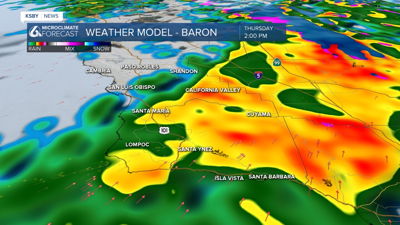
Bands of heavy rain will push through along with strong winds. I expect power outages ponding and potentially flooding for many spots.
With this shift in timing, accumulation totals have fallen slightly 1.5-3.5" will be widespread but ridges and peaks will still bring the highest totals 4"-8" with a few peaks getting close to 10"
Many alerts will be issued for this system (so be sure to stay aware) but there is already a Flash Flood Watch in place for areas surrounding the Lake Fire burn scar for all of Thursday.

Bottom line, the storm will arrive a little earlier than original estimates and that has slightly decreased accumulation forecasts. Unfortunately, that also means that overnight and commute-hour flooding is expected.
——— Original Article———
Good morning Central Coast!
A significant storm is headed our way with the potential for heavy rain, high-elevation snow, and gusty winds. This storm is expected to be the most substantial rain event of the season thus far, I have full details on that below. But first here are the nuts-and-bolts of today's forecast!
Chilly although clear conditions are in store to kick off the morning, if you get out there early enough you can even catch a nearly full moon (tomorrow for the true full moon it will be too rainy to see)
Highs will be a few degrees below normal in the upper 50s and low 60s today. Winds will be calm and sunshine will be abundant.

Now that is out of the way, our headline is a massive system that will be impactful for the Central Coast through the rest of this week.
First, a small "appetizer" storm will reach us beginning late Tuesday and lasting through Wednesday morning. This will mostly be light to moderate rain and will bring less than half an inch of rain accumulation to the region. While this will be noticeable it is nowhere as impactful as our main event that will arrive late Wednesday and last through Friday morning.
The storm is a low-end atmospheric river event, we know these conditions well. Heavy rain, flooding concern, and high winds are expected.
The rain will begin late Wednesday night and bring moderate to heavy rain through the day. The greatest time period of concern is for Thursday afternoon when the core of the storm moves through.
Ahead of the larger system, a Flash Flood Watch has been issued for all recent burn scars in southwest California which also includes the Lake Fire scar in Santa Barbara County. These areas are at the greatest risk for damaging flooding and debris flows. The Flash Flood Watch is in effect from 10 AM Thursday until midnight Thursday night.

Our flash flood watch is just one of the many alerts issued, all due to all the combination of very heavy rainfall and recent burn scars.

Rainfall amounts of 1.5 to 3 inches are expected at lower elevations, with 3 to 6 inches across the mountains and foothills. Portions of San Luis Obispo County could see even higher totals, with 3 to 5 inches along the coasts and 6 to 10 inches in the Santa Lucia mountains.

Heavy, wet snow is also a concern for elevations as low as 6000 feet, with the heaviest totals (10-20+ inches) expected above 7500 feet. For the Central Coast, we don't have a lot of mountains that high. Winter storm advisories are possible.
Damaging winds, especially at higher elevations, are also possible with this event, particularly along a cold front moving through the region Wednesday night through Thursday night. These strong winds could lead to isolated power outages.
Conditions will improve rapidly on Friday, with quiet weather expected through the weekend and into early next week. Temperatures will rebound beginning Friday, with near-normal temperatures returning by Sunday.


Have a great day Central Coast and be sure to stay weather aware and up to date on the latest conditions this week.
