
Good morning, Central Coast! Yesterday was a soggy one for sure with many locations picking up inches of rain.
San Marcos Pass got more than 10” of rain while much of Santa Barbara County experienced 2-3” of rain. SLO County got a little less generally with 1-3” and Rocky Butte with nearly 6” of rain.
Here is a look at rain totals across the region.
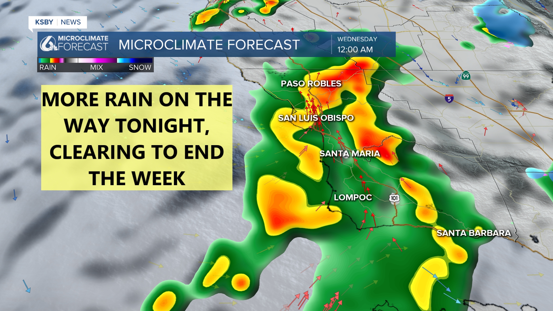
Despite how this morning looks we aren't done yet with the rain. This afternoon a few scattered showers will move through as the daytime heating capitalizes on the instability already in place in our atmosphere. These showers will be quickly moving this afternoon.

Overnight though the more substantial rain from our remaining rain chances arrives. This will be a line of storms that will bring overnight rain. This will at times be heavy but isn't expected to bring too much rain.
That being said the additional 0.5" in most coastal valleys and up to 1" along our south coast will continue to increase flooding risk.

There is still a flood watch in place for the region because we are saturated and with rain in the forecast, it wouldn’t take much to cause additional flooding.

The high surf warning continues for the west-facing beaches for 15-20 foot breakers and dangerous rip until 9 p.m. Tuesday. A high surf advisory continues for the South Coast for 6-10ft waves through Tuesday at 9 p.m.

Additionally, there is a coastal flood advisory in place until 9 a.m. Tuesday for coastal flooding due to the combination of tides and surf. The morning tidal bulge will be near 5.7ft.

As far as the forecast "basics" go, highs will be in the low 60s today.
Temps are set to warm up as we push into the clearer pattern next week.
By the weekend, there is another rain system likely. Not huge but still worth a mention.
Have a great day Central Coast!
