Good morning Central Coast!
The last week has been very active across the West Coast and our Central Coast Communities are no exception. Inches of rain, damaging winds and even some funnel clouds have been pushing through the region.
For more details on those cold air funnels check out this article!
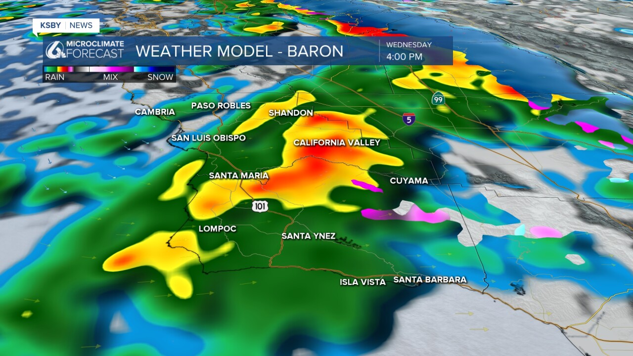
We aren't done yet with this storm though, scattered showers will continue to push through this morning. By early afternoon another low pressure will push into the region and bring a band of heavier rain that will slowly push south this evening. This evening's commute could be a little tricky for many as the storm pushes through.
The band of rain will be short lived but could bring a brief period of heavy rain, that combined with the saturated ground could cause some flooding.

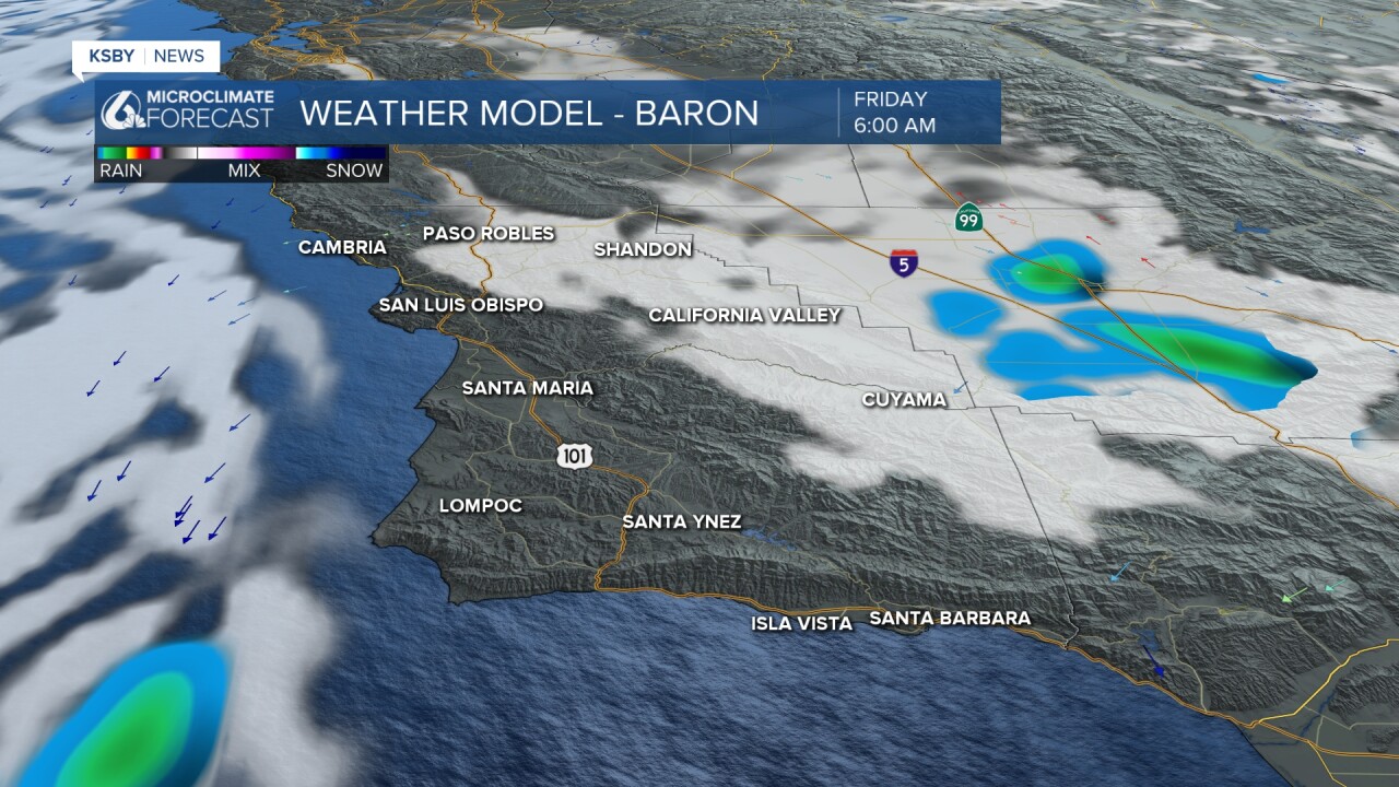
Thursday will once again feature scattered showers, they will clear out late Thursday evening as winds shift offshore.

By Friday morning skies will clear and we will be set up for several days of sunshine!

Accumulation wise this last pulse of the storm isn't going to bring a ton. Most communities will pick up between 0.25" and 0.50" of rain with the highest peaks of Santa Barbara County likely getting some of that in the form of snow and sleet!
That is on top of all the rain we have already seen. Most communities picking up several inches of rain with south coast peaks picking up 10" of rain in the last 4 days. Here is a look at interactive rain totals.
I am watching Lopez lake closely for spillover. As of 10:30 a.m. Lopez Reservoir was at 99.9% of its capacity.
Check out live data from Lopez Reservoir here!
Here are the active alerts for this storm.


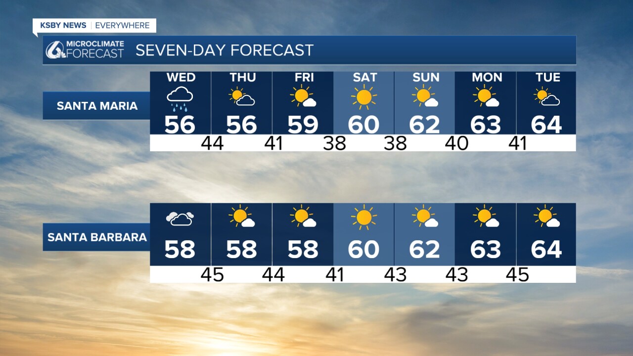
Highs will climb into the mid 60s early next week.
The extended forecast will continue to feature sunshine through next week and into the middle of February.


There are a couple of close misses with rain but no impactful storms are expected until the last week of the month when a system may make its way here. That is a long way out though, nothing to worrisome.
Have a wonderful day Central Coast!


