

Good morning Central Coast!
To kick off our Wednesday morning there is significant cloud cover for many communities and even some drizzle in our coastal valleys to start off the morning.

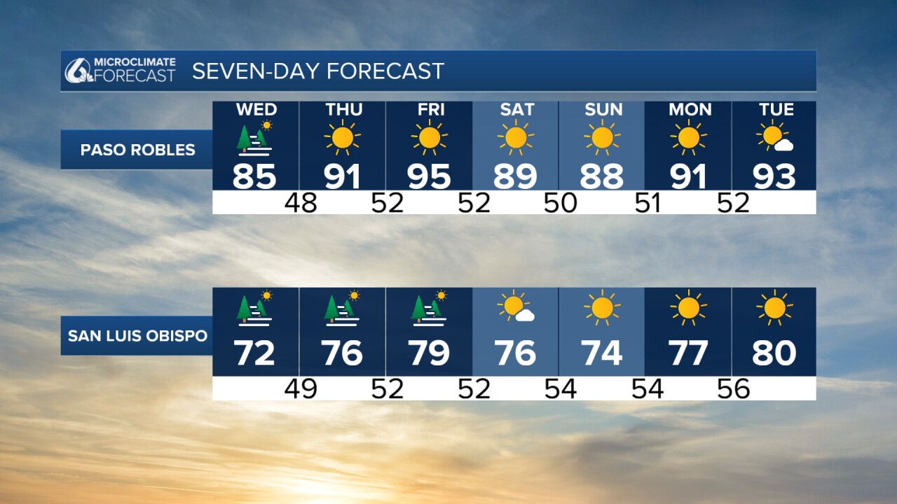
The marine layer this morning is extending to about 1600ft, just enough to spill into the interior valleys over the Cuesta Grade. The cool air this morning will limit some visibility as well as cool temps across the board today.
By mid morning sunshine will begin to break through in our coastal valleys and interiors, unfortunately beaches will stay on the cloudy side through the day.
Beaches will stay on the cool side only in the low 60s. Coastal valleys will reach into the 70s while interiors will fall about 10 degrees from yesterday and be in the 80s.

Over the next few days winds from the south will gain traction and we will warm up a few degrees but clouds will remain a mainstay.

For information on Tropical Storm (soon to be hurricane) Helene check out this link!
Have a wonderful day Central Coast!
