

Happy Sunday, Central Coast!
Expect to see more rain tonight and Monday morning! Before I dive in, here are a few links that I find helpful to have on hand through a storm.
This morning, our region experienced some rain. Hopefully, this rain was not too much of an issue for those of you who participated in the City to the Sea Half Marathon. We are currently in the middle of an 'imperfect break' which started in the afternoon. We've been experiencing some scattered showers during this time.

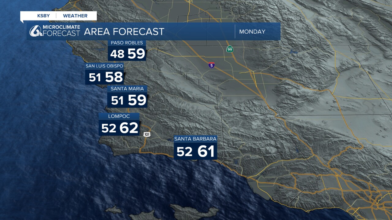
Before we get into what happens next, here is a look at the rain totals recorded in the past four days. The south coast got the bulk of this rain! Several areas recorded anywhere from 6 to 12 inches of rain! You can find additional totals HERE if you would like a closer look.

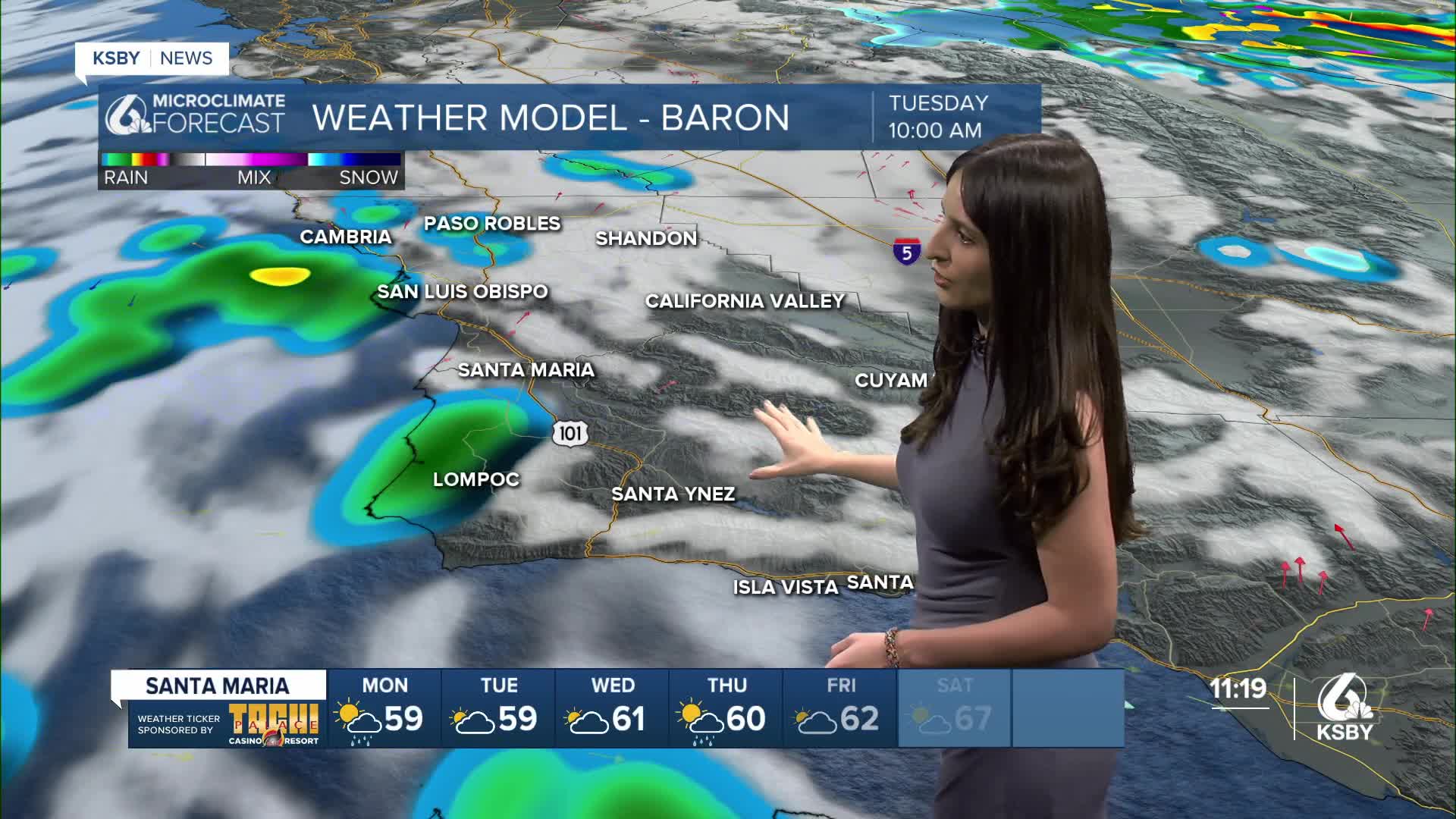
Now, back to this imperfect break. Don't expect this slight pause to last! In a few hours, there will be even more rain. The low-pressure system that has been rotating over our region for the last couple of days will be replaced by a new system. Our model shows this new low-pressure system will arrive on the Central Coast on Monday between 2:00 to 4:00 AM.

The bulk of this rain is expected to happen early Monday morning. Radar shows this cold front will first arrive in the NW part of our region, bringing with it a band of heavier rain, then moving on to the south coast. Expect this rain to happen during your morning commute. Please drive safely!

Monday's temperatures will be slightly cooler than what we saw this Sunday. Layer up!
Here is a look at our extended forecast. Again, a reminder that you should expect rain Sunday night into Monday morning.
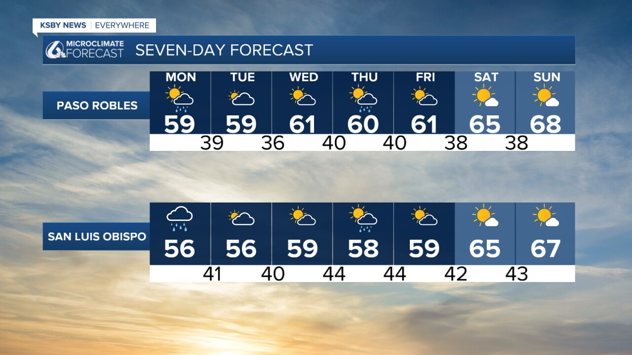
We'll continue seeing scattered showers on Tuesday. We'll get a brief break on Wednesday, but there is a good chance we will see the return of more showers on Thursday into Friday.

Enjoy your evening, Central Coast!
— Leslie Molina
_________________________________________________________________________________________
¡Feliz Domingo, Costa Central!
¡Es un fin de semana tormentoso! Antes de explicarles el pronóstico, aquí tienen algunos enlaces importantes para tener a mano durante estas condiciones climáticas.
Este domingo, experimentamos lluvias por la mañana que comenzaron a debilitarse en la tarde. Actualmente nos encontramos en lo que yo llamo “una pausa imperfecta”: un periodo con lluvias dispersas, pero sin una interrupción completa de la actividad lluviosa.
En la siguiente imagen pueden ver los totales de lluvia registrados durante los últimos cuatro días. ¡Algunas partes del condado de Santa Bárbara recibieron entre 6 y 12 pulgadas de lluvia en este periodo!

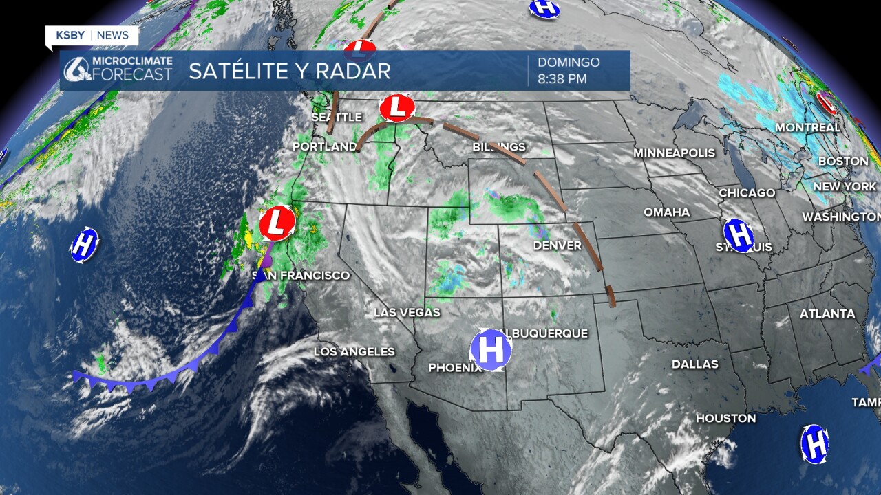
Ahora, hablemos de qué viene después de esta 'pausa imperfecta'. ¡La pausa no durará mucho; en unas pocas horas regresarán las lluvias! El sistema de baja presión que nos ha acompañado estos días se desplazará y será reemplazado por un nuevo sistema de baja presión. Nuestro modelo indica que este nuevo sistema llegará a la Costa Central entre las 2:00 y 4:00 AM del lunes.
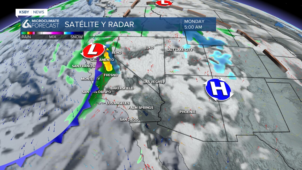
Este sistema traerá un frente frío, que nuestro radar, indica alcanzará primero el noroeste del condado de San Luis Obispo el lunes por la mañana, y luego avanzará hacia la Costa Sur. Por favor, manejen con precaución en las autopistas, ya que la tormenta coincidirá con las horas en que muchas personas se dirigen a sus lugares de trabajo.

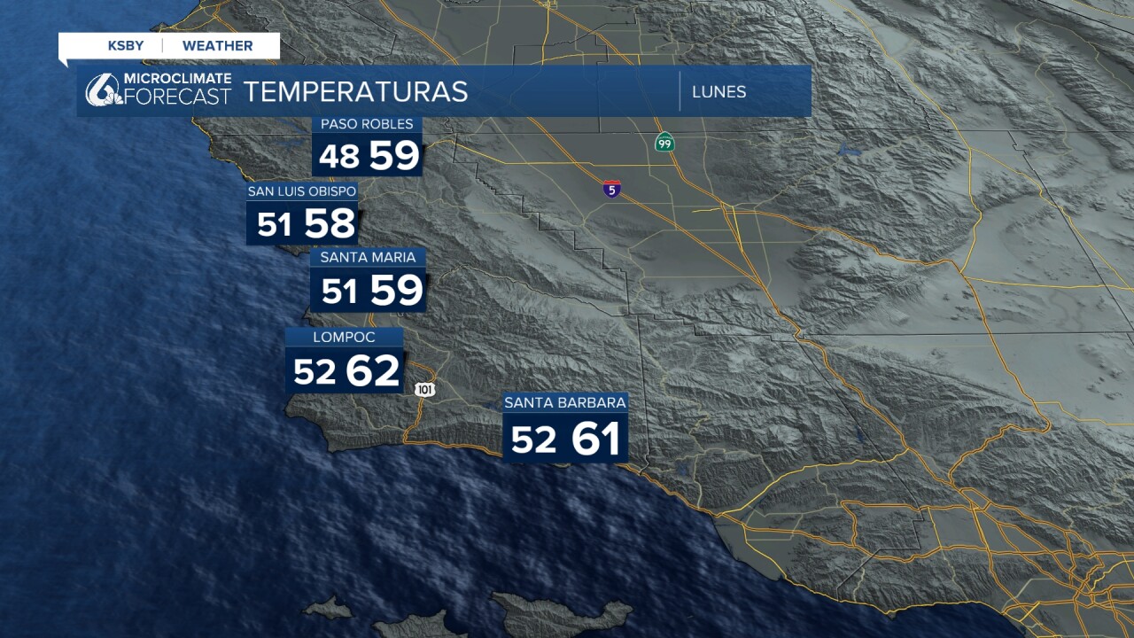
El lunes también continuaremos observando un descenso en las temperaturas.
Este es nuestro pronóstico para los próximos siete días. Si se preguntan cuándo pararán estas condiciones, el miércoles se espera un respiro.

Sin embargo, existe una alta probabilidad de que un nuevo sistema traiga más lluvias el jueves y el viernes.

¡Buenas Noches, Costa Central!
—Leslie Molina
