
Good morning Central Coast!
It is an impactful and in some spots dangerous forecast across the region. Let's dive right in!
Headlines
- Dangerous, record breaking heat for all but our western beach communities.
- 110°+ in interiors, upper 90s for coastal valleys, 70s at the beaches.
- Fire weather continues. Sparks and flames will spread quickly.
- Heat, fire and wind alerts in place.
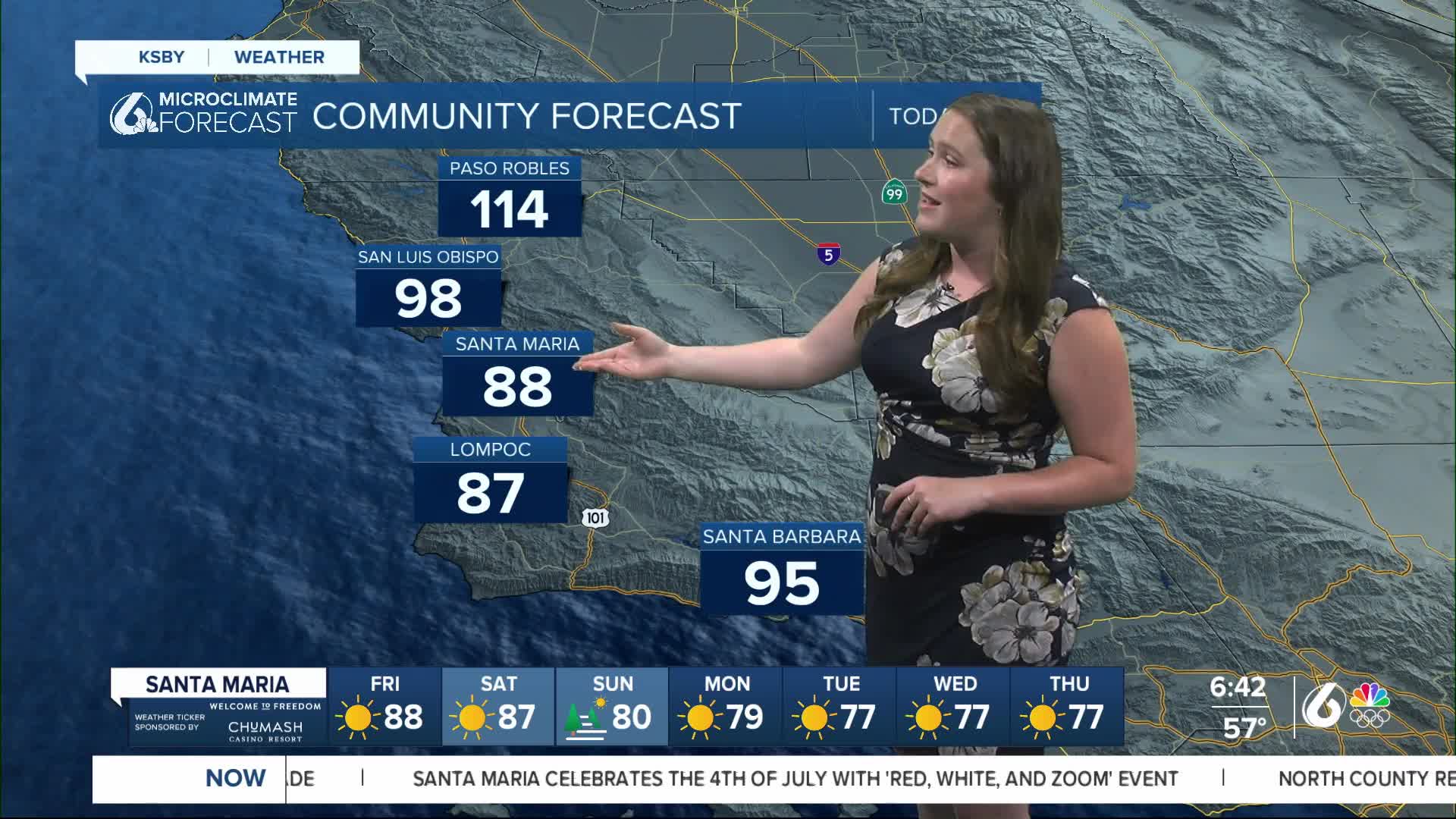
Forecast Discussion
Thursday, the 4th of July was a scortcher across the region although communities just missed records in most spots. Here is a look at those high temps.

Overnight into Friday morning the set up for a even hotter day built in. Southcoast communities were under a Wind Adviosry through 5 a.m. as sundowner winds replaced the cool marine air of Thursday with hot dry air for today. That will help to bring a nearly 20 degree jump in temps in Santa Barbara between today and yesterday.
Some dense fog also moved in to the beaches once again. That will be a bit of a concern for commuters but by 7 a.m. all but the direct beach communities will be clear.

Open windows early in the morning to take advantage of the cooler weather but we will heat up quickly as the day goes on.
High temps will jump up to 5 degrees for interiors and nearly 20 degrees for some coastal valleys and out western beaches. Here is a look at those temps.

Heat is the number one weather related killer in the United States. Take the concern seriously.
Here are the alerts in place across the region.
- Excessive Heat Warning for San Luis Obispo and Santa Barbara counties is in place until 6 p.m. on July 10th.
- Heat Advisory for San Luis Obispo and Santa Barbara counties ends at 6 p.m. on Sunday.
- Fire Weather Warning until 6 a.m. Saturday for all interiors and south coast communities.


Residents are advised to stay hydrated, avoid outdoor activities during peak heat hours, and check on vulnerable populations.
Turning to the extended forecast, Friday is looking to be the hottest temps for the forecast in our coastal valleys but interiors will continue to heat up through the week. Highs near 110° continue to be the story through early next week when temps will back of a tiny bit and be near 105° into the extended forecast.


The Climate Prediction Center is expecting well above normal conditions to continue well into the back half of this month.

Have a great day and weekend Central Coast! Stay hydrated and weather aware. For all the latest weather updates be sure to download the KSBY Microclimate Weather App for all the latest weather headlines.
