

Good morning Central Coast!
It has been a bit of a soggy week across the Central Coast, today is no different. Another cold front is barreling through the Central Coast.

Before I dive into the forecast, here are some links I find helpful amid storms.
The rain started off light this morning but has become heavier as the storm pushes east. Brief heavy rain is expected but thanks to the quick movement of the storm accumulations will be limited to 1/3 to 1/2 inch from this system. The showers will be widespread but thankfully not continuous. By early afternoon, the main area of instability will push SE, that will clear us out and showers will be much more isolated by the afternoon.

Gusty winds are keeping the showers moving that will prevent significant rainfall accumulation in any one area. While a brief thunderstorm can't be entirely ruled out, the chances are decreasing as the day progresses.
There are a few alerts in place.
A wind advisory is active for the western beaches and coastal valleys through 8 p.m. Friday night. Plus a winter storm warning is in place through Saturday at 5 a.m. for the interior high elevations of Santa Barbara county.

There is also a high surf advisory for all beaches though 3 a.m. Saturday.

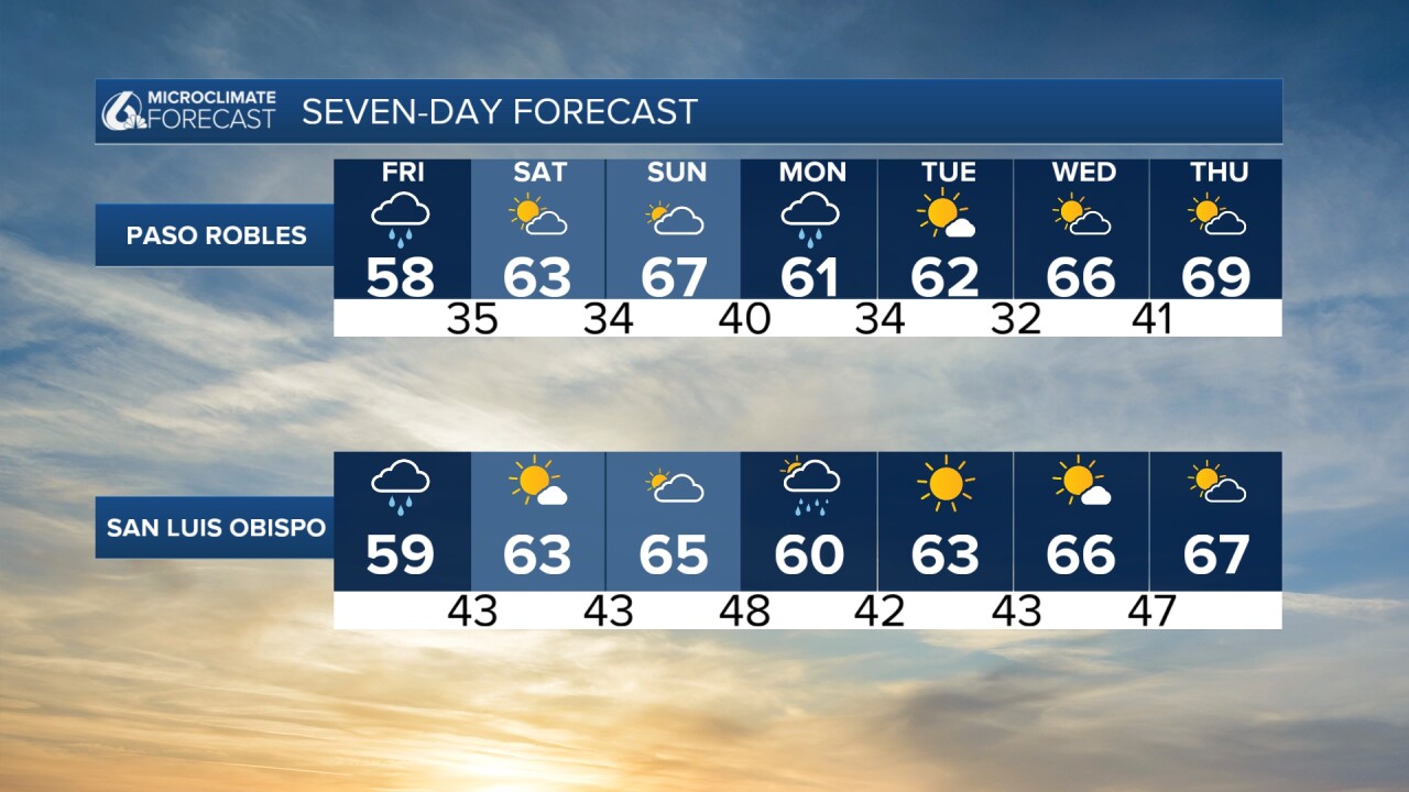
The weekend is expected to bring dry and warmer conditions as a ridge of high pressure builds over the region.
Looking into early next week, Monday will see the tail end of a storm system clip the area, bringing a chance of showers, primarily north of Point Conception. Rain amounts are expected to be light, with little to no rain south of Santa Barbara. The remainder of next week will be dry, with occasional gusty northwest winds and temperatures near normal. The departing storm system will leave behind a drier air mass, allowing for a return to more stable weather conditions.

Have a great day and wonderful weekend!
