


Good morning Central Coast!
We made it to Friday! A the day kicks off winds have shifted slightly and with that change more clouds are in place. This will help keep the coastal valleys a bit cooler today but it will also bring some light mist for the morning commute. Just something to be aware of.
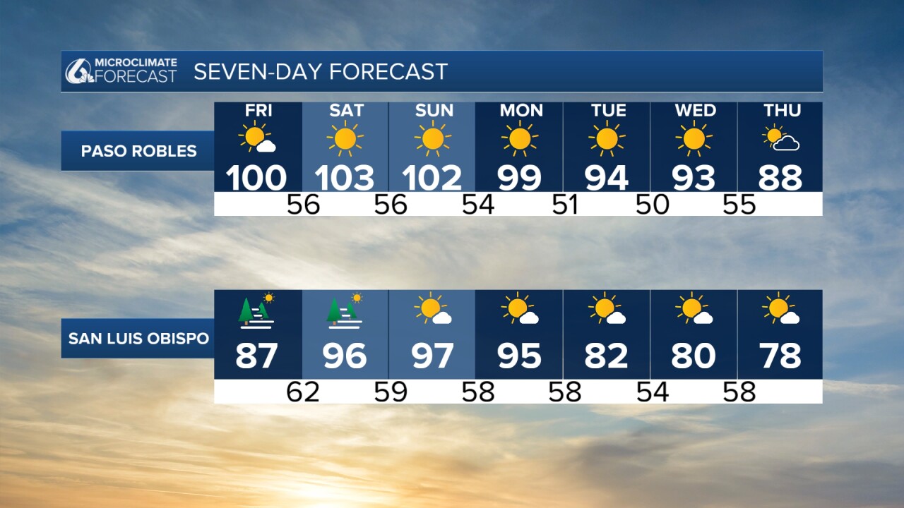
The stubborn high pressure that has been parked over our region bringing all the heat has shifted slightly east and will allow a slightly cooler Friday across the region. Don't get me wrong though these temps are still 15 to 20 degrees above normal for this time of the year.

Temps today will still hit triple digits in the interiors. Upper 80s to 90 in the coastal valleys while beaches will be in the 70s.

A quick FYI for Friday, with the now onshore winds from the south a few small storms are expected to pop up. The air is so dry across the region that the water will mostly evaporate before it makes its way to the surface. That just leaves the risk of dry lightning in the evening hours. Be aware of the heightened risk of wildfires.
Elevated showers will move over #SanLuisObispo & north #SantaBarbara Counties thru the day. The very dry air near the ground will evaporate most of any rain. Cannot rule out a dry lightning strike which could start a fire. High fire risk residents stay aware today. #cawx pic.twitter.com/47Mhk0VO3w
— NWS Los Angeles (@NWSLosAngeles) October 4, 2024
Saturday the high pressure will reestablish itself once again bringing soaring temps into the weekend.
Record highs will once again be possible for interiors through Monday. In advance of this an Excessive Heat Warning is in place for the interior valleys through Monday evening at 8 p.m.

Sunday will see a bit more warming along the coast, but some slightly cooler air will sneak into inland areas. However, it won't be enough to completely get rid of the heat. By Monday, a more significant cool down arrives, especially for inland areas. Tuesday and Wednesday will bring even more relief, with temperatures dropping and more extensive low clouds along the coast.

Remember to stay hydrated, avoid strenuous activities during the hottest parts of the day, and seek out cool places if you can. Check on elderly neighbors and those who may be vulnerable to the heat. And never leave children or pets unattended in vehicles.
Have a wonderful day and weekend ahead!
