Good morning Central Coast!
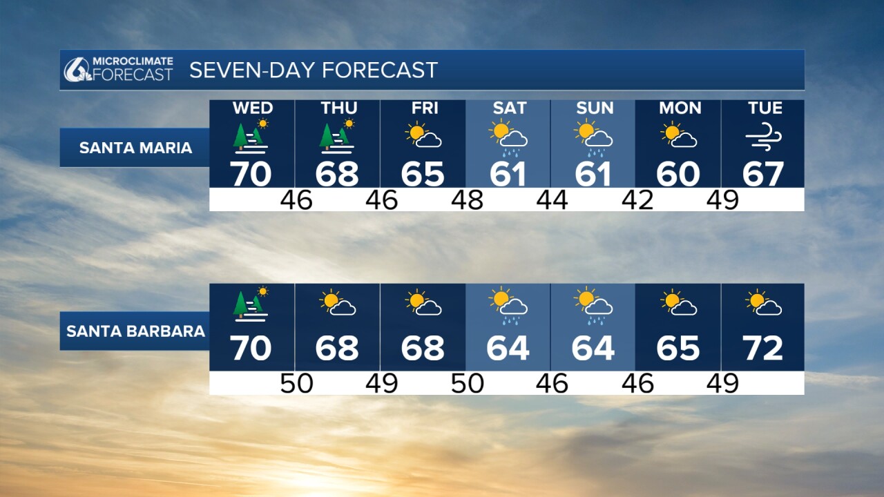
It is the first official full day of Spring (the vernal equinox was Tuesday evening at 8:06pm) and we will see great conditions across all of our communities! Sunshine and temps in to the 70s are expected this afternoon.
Before we get there though there is some dense fog in place across the region, this is mainly impacting Western Santa Barbara County but for all drivers this morning take caution!

We have a little more time left with mild conditions. Night and morning low clouds near the coast the next few days but clearing should be quick and more 70s are in the forecast for many non-beach communities while beaches remain in the 60s.
With all of these sunny skies and warm temps it is easy to forget that we have rain on the way. Here is a quick look at that pattern change.
By Friday evening more cloud cover will be in place ahead of a decaying cold front pushing south. That storm will be light but still brings showers to our communities. Another storm is right on its heels and will bring light widespread showers Sunday.
All said and done northern SLO county will see the majority of the rain while the south coast will pick up just a few hundredths of an inch.

Monday and Tuesday next week look dry and temps Tuesday could warm back into the mid-60s but modeling is suggesting a series of systems from Wednesday next week into the end of the month.
Current computer model runs start April off with a significant system (potentially). This is at the end of the model run where the math gets a little speculative but it is safe to say that a more active and cooler pattern is likely to close the month and begin April.


Have a wonderful day Central Coast!


