
Good morning Central Coast!
The last few days have brought cooler than average temps day after day and while there is relief in sight it is going to be a while before we see that.
To start off the morning cloud cover is in place with only a few spots battling fog in the interior valleys.

The fog will clear quickly but the clouds will be slower to leave. Most spots will clear slowly for some sunshine in the afternoon.
Despite some sun temps are still cooler than normal for this time of year. 60s and uper 50s by the coast with interior valleys climbing towards 70.

Copy-paste today's conditions to tomorrow and you have that forecast!
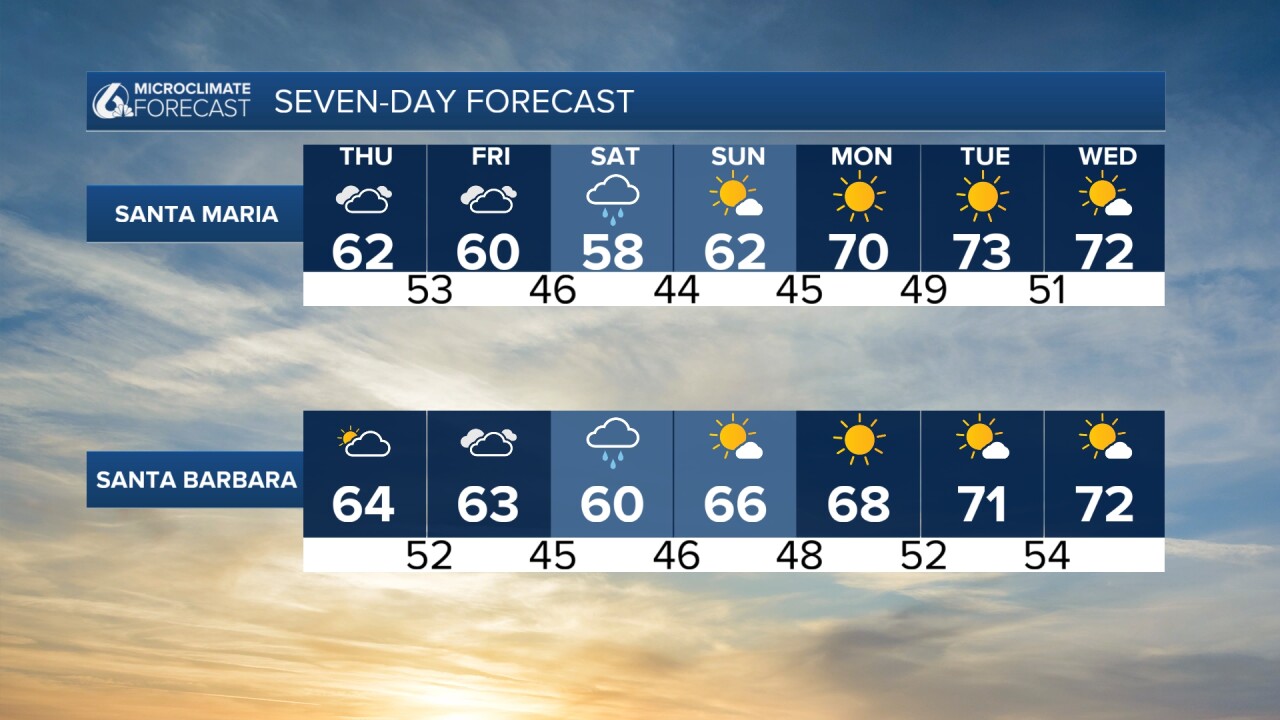
Friday night though things will change more significantly. A decaying cold front is pushing towards the west coast descending from a low near Alaska. This will reach us late Friday night into Saturday morning.
The majority of the rain will be overnight in a single band of rain. This could be heavy at points but will pass quickly and leave behind lingering showers for the rest of Saturday.

Totals will be highest by the beach and will wane as it pushes east.

Once the cold front pushes through and the rain clears we will see another big shift in conditions. Higs will climb and much more sunshine is the story into next week.

Have a great day, Central Coast!
