


Good morning Central Coast! Happy Friday, I hope everyone got outside the last few days because rain is on the way and a soggy weekend is about to begin.
Diving right in, several systems will impact the area Friday afternoon through Monday. There will be some lulls in activity over the weekend, but the cumulative impact will mean inches of rain for our communities.
Right now, the calm before the storm continues. Just the increasing clouds we were expecting.
There will be mostly cloudy skies through this afternoon. Temps Friday will not be severely impacted, temps in the upper 50s and low 60s once again.
This afternoon a cold front will push through and bring scattered showers across the region. Timing-wise the first rain chances will move in by 3 p.m. and spread out to become more substantial this evening.

On and off showers will continue through the overnight hours with more substantial showers building in Saturday night. Up to that point, most showers will be mild with maximum accumulations around an inch.

Sunday night into Monday morning the storm will pivot into a more intense pattern with heavier rain and the chance for thunderstorms. This final portion of the storm will bring substantially more rain.
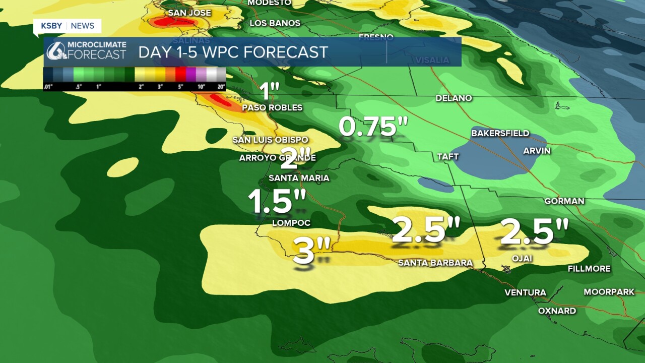
With the cumulative potential, there is some potential for small stream and urban flooding. Aside from the rain winds and waves will be a concern with alerts already issued.
Additionally, winds will pick up. Friday PM into Saturday some S winds 15-20 with gusts past 25mph are possible. Another similar wind event is possible later Sunday into Monday. No advisories yet for that but something may be issued later.
There are surf advisories for SLO and Santa Barbara counties from Saturday into Sunday. The largest waves in SLO County (8-12ft). But 4-7ft in the channel is also enough for an advisory.

Snow levels during this system are very high locally (and regionally). Above 7000ft for any significant accumulation.
After Monday, models don’t see much coming into early February.
Just a note, this is technically not an atmospheric river event though we are very close to a plume Sunday into Monday. The location of the plume is something to watch.
Have a great day Central Coast!
