

Good morning Central Coast!
Heavy rain was the story overnight and with another storm waiting in the wings it is going to be another active set of days. Here are a couple of helpful links to have on hand!
The last 24 hours have brought significant rain to the Central Coast with some spots picking up well over an inch (ridges over 5 inches), that prompted a flood advisory overnight through much of SLO county but that has expired and as we push into our Wednesday morning rain is still an active concern. Pooling water on roadways and poor drainage spots is expected for the morning commute. Take caution on those roadways.
Here is a look at some of the rainfall totals we have seen so far!
Drizzle will be the story this morning for many of us, along the south coast though rain will be a bit heavier with a quarter inch of rain possible today.
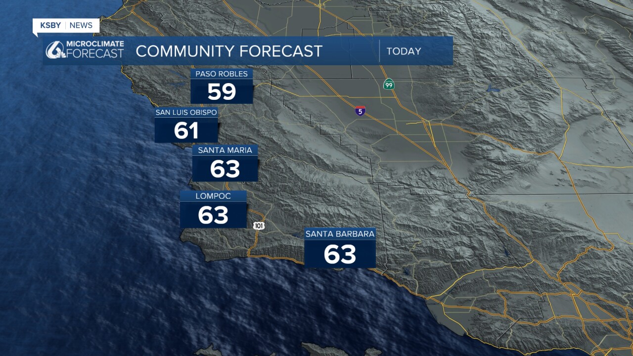
Today will bring us a break in the rain, an imperfect break but still a change nonetheless.
Highs will be in the mid 60s and low 60s, nothing too headline worthy.
Tomorrow though things will change once again. A storm system currently spinning out in the pacific will arrive and bring us more rain once again.
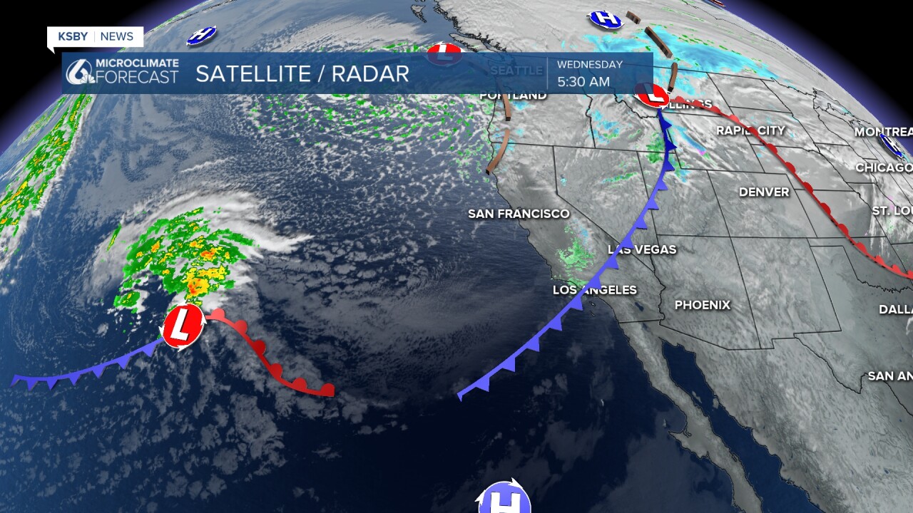
Showers will begin mid-morning and spread south through the day. By sunset, all communities will be seeing rain once again. This will last into Friday morning before we clear out with a more substantial break.
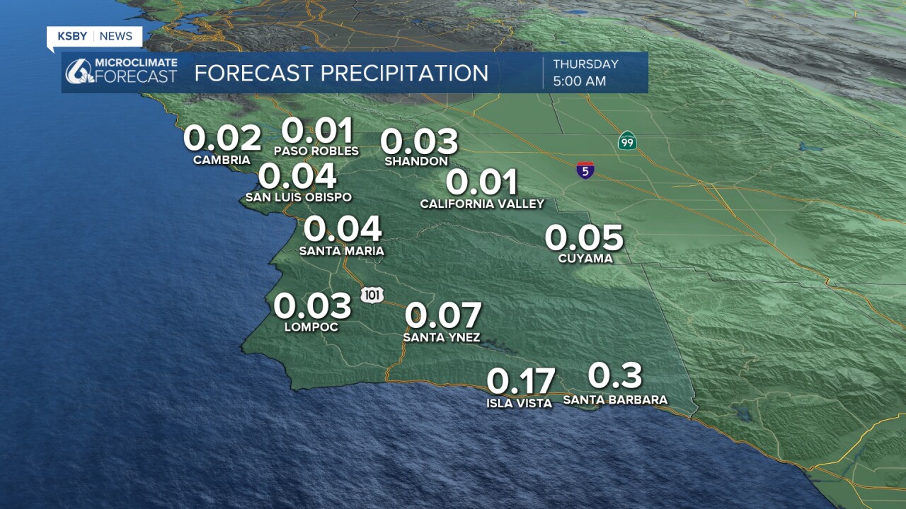
As far as further accumulations go, topography will once again play a huge role. South coast communities will pick up another inch of rain with similar totals in the SLO County coasts. Interiors and northern Santa Barbara county will see less.
Here is a look at all of that distilled into a 7-day forecast!

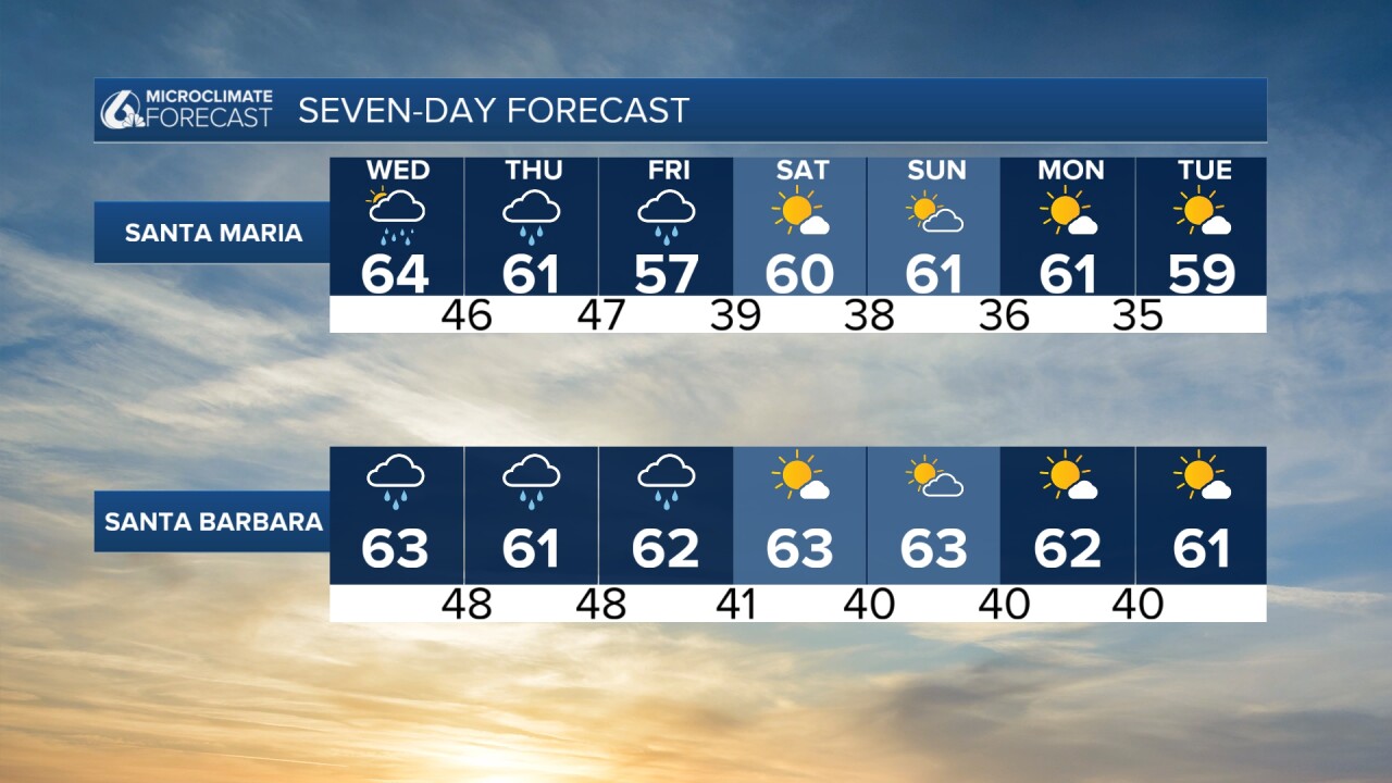
There is another chance for rain by the end of next week. That is still a long way out but I will keep an eye on it and bring the latest as it becomes available.
Have a great day, Central Coast! As more rain moves through the region over the next few days, remember to stay weather-aware.
