

Good morning, Central Coast!
This morning is on the cool side, but the big story is continued cloud cover.
Today will start off with more clouds and even some patchy areas of marine influence-based drizzle. This will not impact us too much, just something to be aware of.
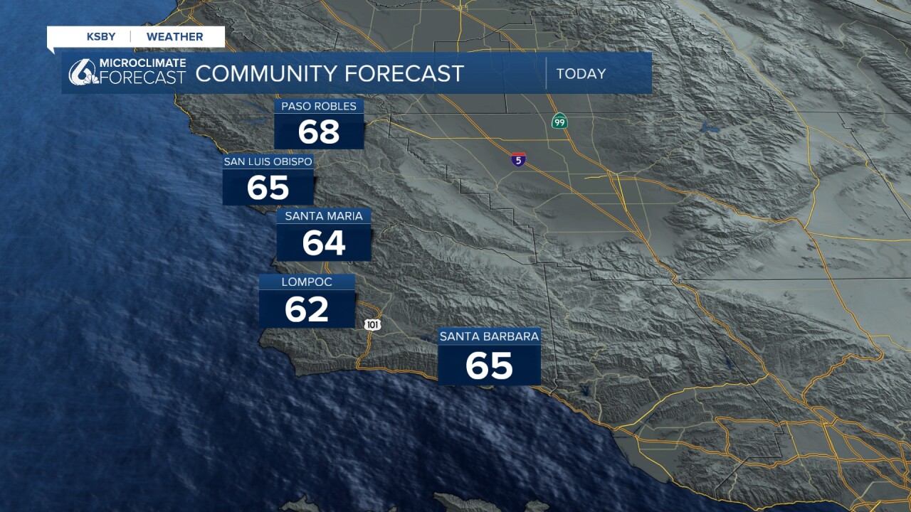
Through the day, clouds will stick around, by the afternoon, we could catch a few peeks of sunshine later today as well.
This cooler shift in our pattern is all thanks to a weak low-pressure system that will "wobble" across the Central Coast, bringing the cooler and cloudier weather. Wednesday night into Thursday morning, very light rain is possible for the far interior valleys.

On Friday, that low pressure will begin to push east, and we can once again look to high pressure and warmer weather.
The weekend will feature sunshine and warmer temps. The temps will once again climb to above average with more sunshine!


Have a great day Central Coast!
