

Good morning, Central Coast!
High heat is here, with little relief on the way. Here is what you need to know.
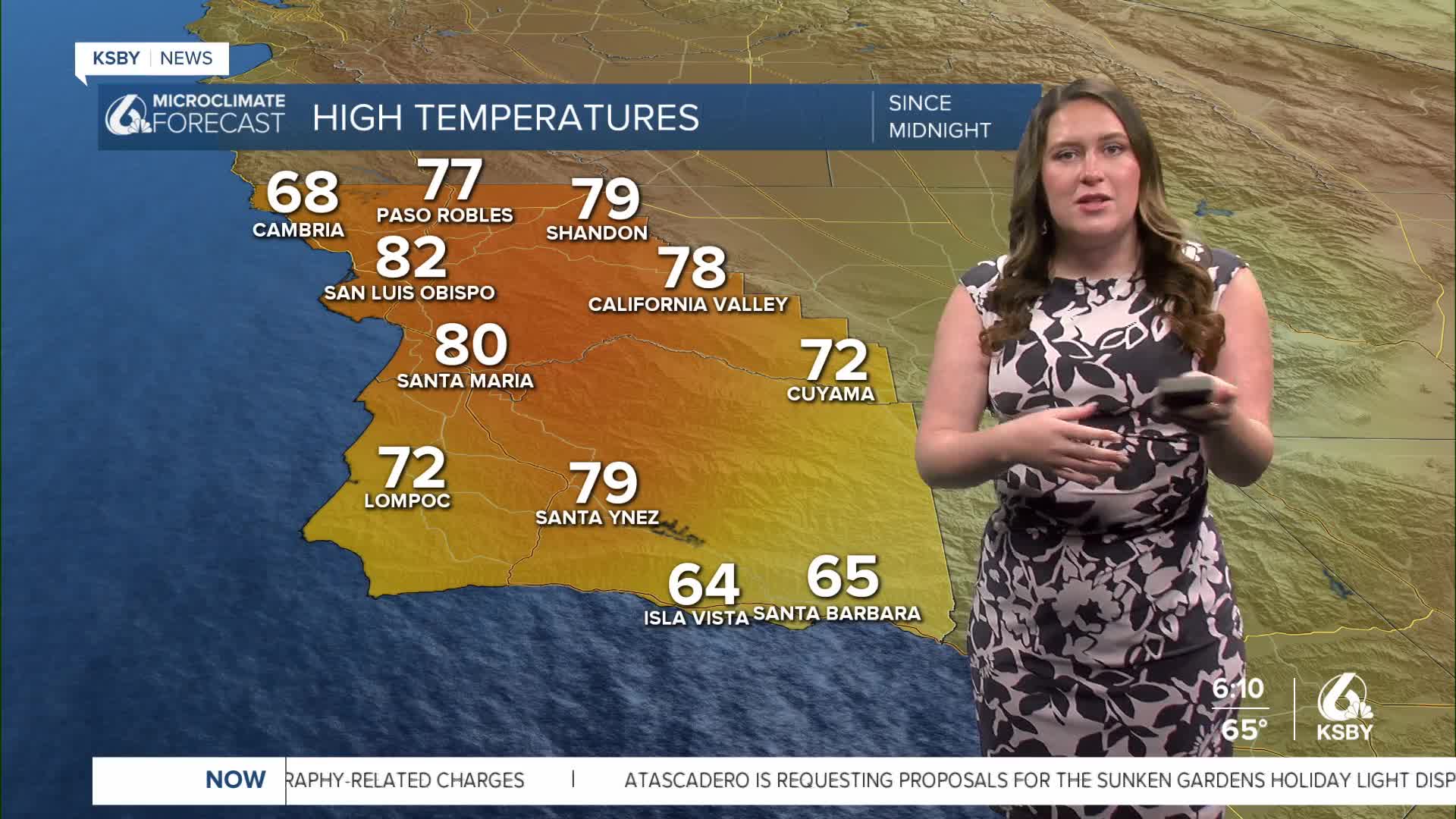
We kicked off the week with very seasonal conditions with highs in the mid 60s (typical for this time of the year), but yesterday a large-scale high-pressure system moved in and began to warm temperatures. Wednesday highs reached the upper 70s and low 80s for many communities. That marked a massive warm-up from just the day before. Here is a look at the temperatures at 4 p.m. Tuesday compared to the temperatures at 4 p.m. Wednesday.

Today we will continue that warming trend with more highs soaring into the 80s and some spots even reaching 90 degrees today. Those temps are 20-30 degrees above normal for this time of the year.


I do want to be clear about one thing: temps in the 90s are not unusual across the region, but those are reserved for the summer months. Reaching these highs this early in the year is nearly unheard of. In the Palm Desert, we could see temps in the triple digits two months before normal.
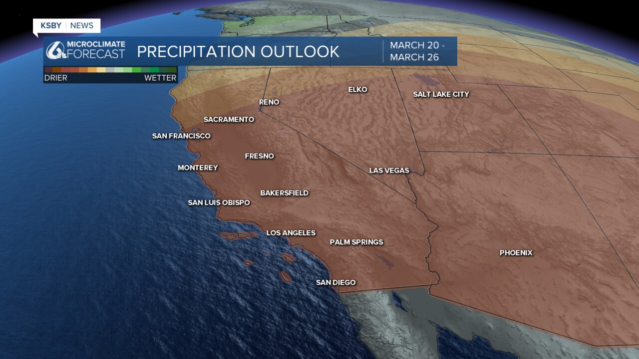
The reason for all this warmth is a large high-pressure system that is settling in and will stick around for a while.

Due to these much warmer than normal temperatures, there is a heat advisory in place for all beaches and most coastal valleys through 8 p.m. Friday. I wouldn't be surprised if that advisory were to be extended through the weekend.

High temps will stay in the 80s and 90s through the weekend and into next week.


Even into the further extended forecast, no major relief is on the way; more high temps and dry conditions are in place through the end of this month.

Have a wonderful day, Central Coast! Be sure to stay hydrated!
-Vivian
