
Happy slightly soggy Saturday Central Coast!
Just as expected overnight storms pushed through the region bringing significant rain to the Central Coast. We aren't done yet though more rain is expected through Monday Afternoon. Myself (Meteorologist Vivian Rennie) and Eduardo Huijon Jr. will be tacking these storms as they pass through.
Here is a look at your Interactive Radar!
Here is a look at some of the totals from Friday night through 11 a.m. Saturday Morning.
For more communities check out this interactive map!
Turning to what is left from the storm.
Scattered showers are expected through Monday morning. Thankfully though this storm will bring the most substantial accumulations overnight tonight and Sunday. How considerate!
Saturday will feature some scattered light showers but the rain won't really pick up until this evening, then the showers will become more widespread and will contain areas of heavier accumulations through the overnight hours.
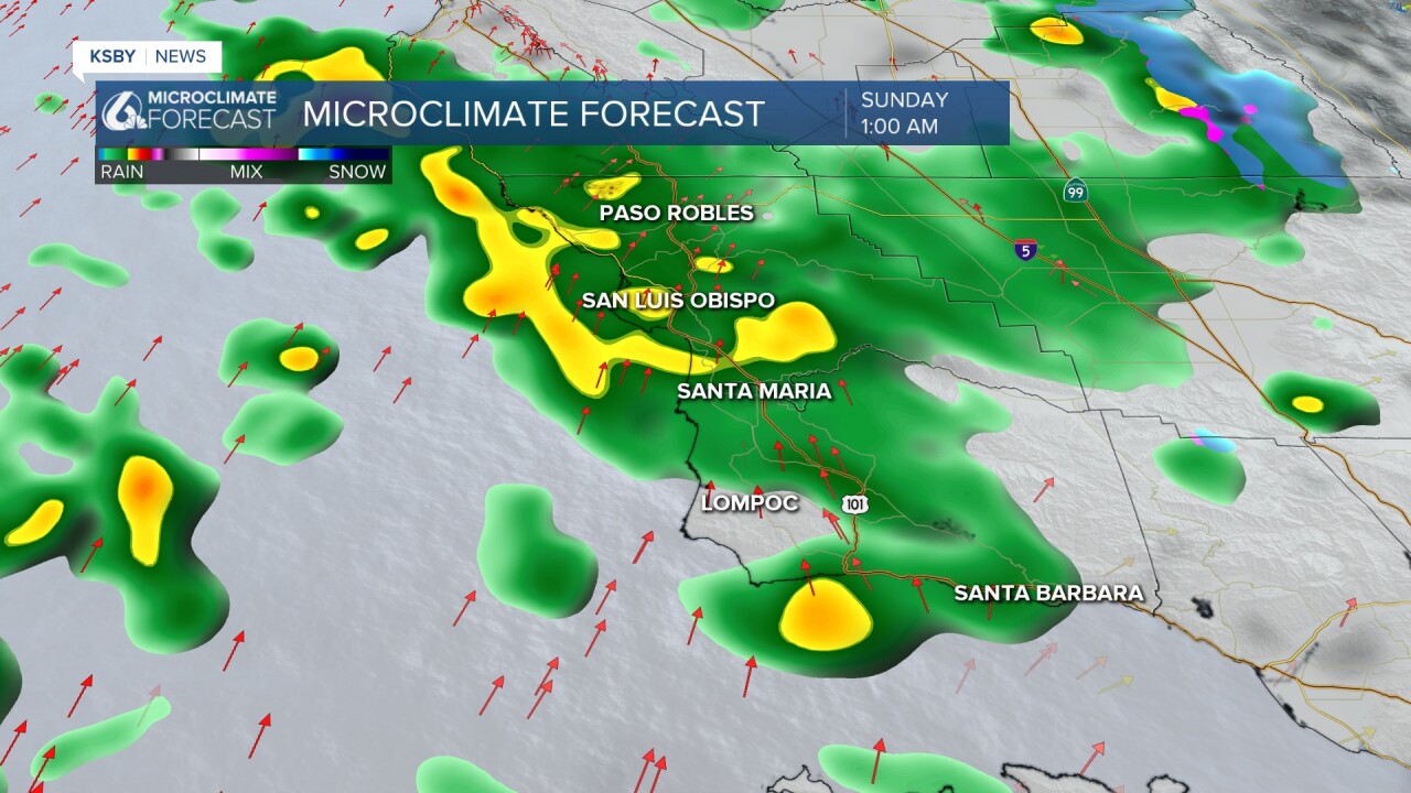
The radar will likely clear out by mid morning and will stay clear through most of Sunday!

Sunday night the nature of the storm will change as another cold front drives through the region. This will bring heavier bands of rain and strong southerly winds late Sunday night into early Monday morning.

Thunderstorms and localized flooding is possible as we kick off the new work week. Stay prepared and aware.
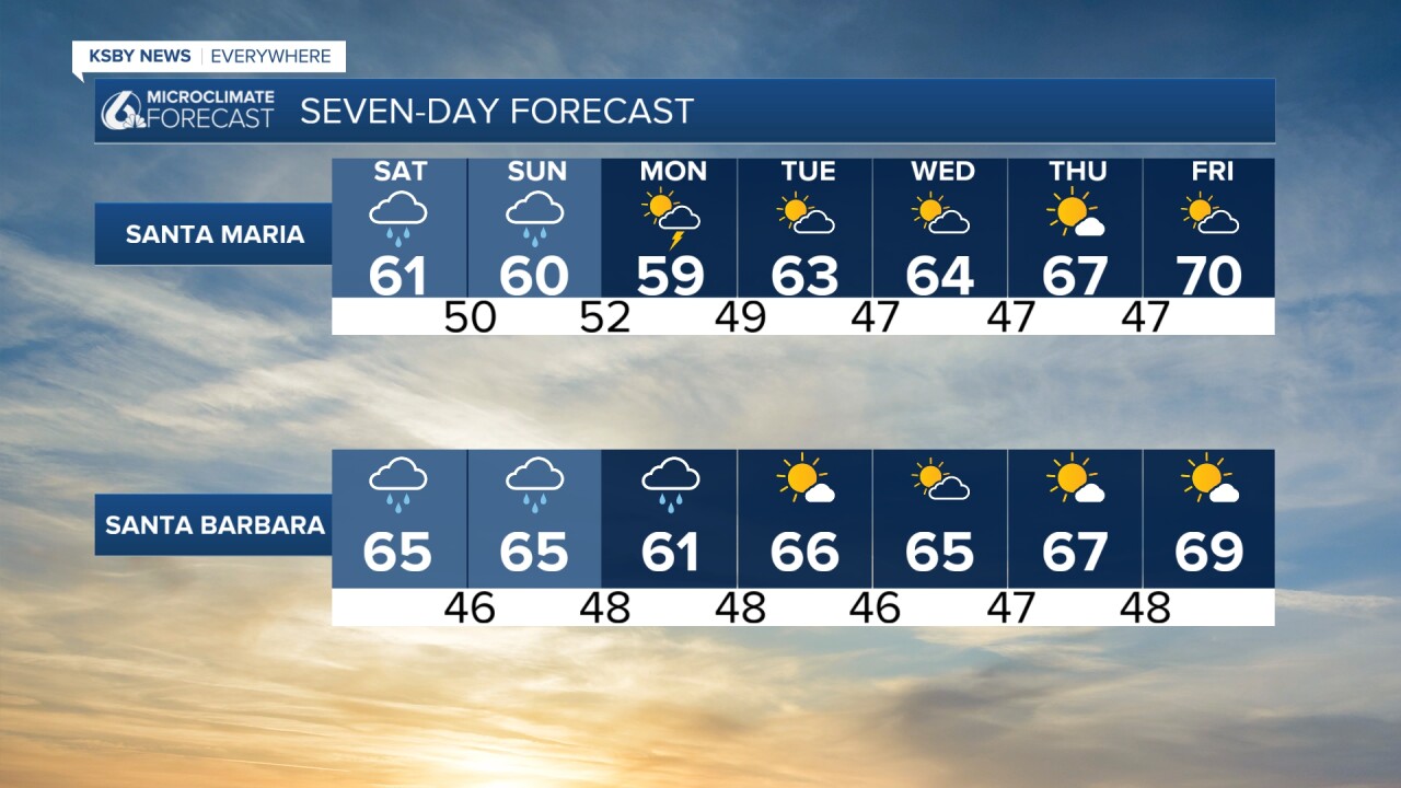
All said and done between 0.75" and 1.5" of rain is still expected from this pattern through Monday for San Luis Obispo County with the higher end of that range expected for the North Coast Communities.
Southerly winds will help the south coast pick up another inch of rain, closer to a half inch in the rest of Santa Barbara County.

It is not just the rain that we are keeping an eye on, waves and tides will once again combine. This is enough of a risk that a coastal flood advisory has been issued for all of of our beaches Though 10 a.m. Sunday morning, plus a high surf advisory is in place through 4 p.m. Sunday.


High tides will peak at around 6 ft just after 6 a.m. tomorrow, that combined with 9-14 ft waves may be enough for some slight tidal overflow. Damage, if any, is expected to be minimal but safety is a concern.
By Tuesday morning winds, waves and our tides will have calmed down and sunshine will begin to shine again. Temps will warm up consistently through the week and many communities could see 70s by the end of next week!

Have a wonderful weekend Central Coast!
