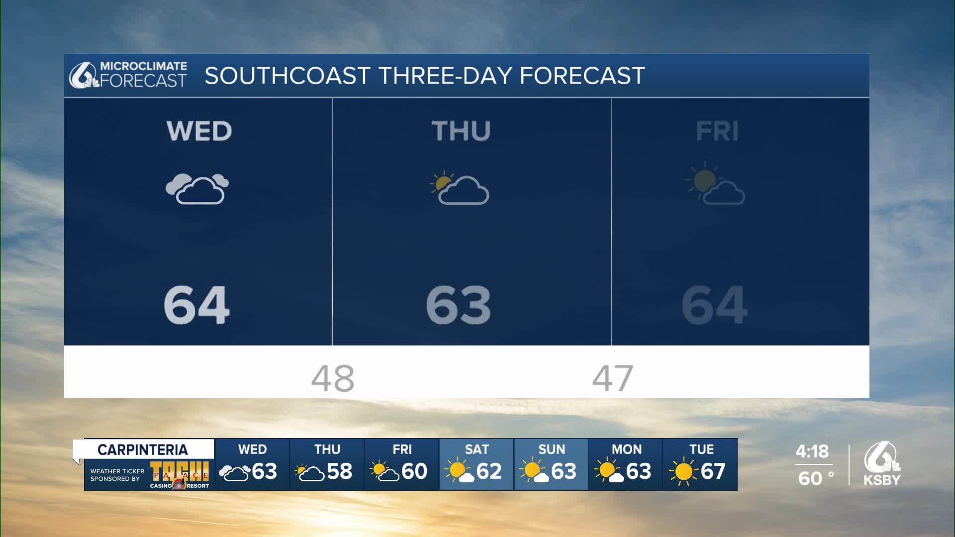

The Central Coast will experience more strong onshore flow and a deep marine layer the rest of this week, bringing persistent low clouds and fog at night and in the mornings, with a chance of drizzle each day.
Showers are looking less likely on Friday. Dry and warmer conditions are expected for the weekend and into early next week.
An upper low situated about 500 miles west of the Central Coast will slowly move eastward, reaching the Central Coast area on Thursday during the day. This will maintain cool and mostly cloudy conditions for the next couple of days, with the marine layer deepening.
The marine layer was around 3000 feet deep this morning and will likely deepen as the low approaches and temperatures aloft cool. This increases the chances for drizzle, which may feel like light rain at times. The airmass is unstable, so we'll have to watch the radar for potential pop-up rain at higher elevations in the mountains of SE Santa Barbara County, but the chances are not great.
Wednesday: As the marine layer deepens, coastal areas may begin to see more sunshine, while valleys remain cloudy. This is called "reverse clearing". Temperatures will remain below normal.
Thursday: As the low moves onshore, drizzle and light rain chances increase, but for most of the Central Coast, this is less of a concern than it is further south near Los Angeles.
Friday: A second upper low dropping down from Canada through the Great Basin will maintain the deep marine layer. We'll have to watch for the chance of rain, however, models today put this feature too far east to be a large rain threat. More mist and drizzle can result, but it would be similar to what we've seen much of the week.
Weekend and Beyond:
A warming trend will begin on Saturday as both upper lows shift quickly east and weak high pressure develops in their wake. Temperatures for coastal and valley areas will still be slightly below normal, with highs ranging from the mid to high 60s at the coast to the 70s inland.
The extended forecast shows a low-impact weather pattern through at least the middle of next week, with the only potential hazard being some gusty winds across the far interior areas during the afternoon and evening.
