


Good morning, Central Coast and happy Tuesday!
Strong storms overnight have brought heavy rain to much of the region and will continue through today ahead of a cool extended forecast.
Diving right in, a flood advisory was in effect for portions of the region until early this morning. While these have expired there is still standing water on many roadways and hazardous runoff/stream conditions this morning. Take caution.
As far as rain totals go from overnight, they are very localized, the 5 Cities saw the most rainfall so far with nearly half an inch. For locations not impacted by the thunderstorms totals are in the hundredths of an inch.

An interactive map of rainfall totals so far can be found here!
More storms are expected to move onshore this morning as the low pressure brings "wrap around" moisture to the region. Latest models are showing less impacts for the day today, I am not sold on that, more rain, up to a quarter of an inch (outside of thunderstorms) is expected.
This morning rain will mainly impact western beaches moving slowly south wast to bring thunderstorms to the southcoast by this evening.
We aren't done yet in the north though, showers will move back in late tonight into early Wednesday morning.
Thunderstorm risk is still present across the region. Here is the outlook from the Storm Prediction Center.

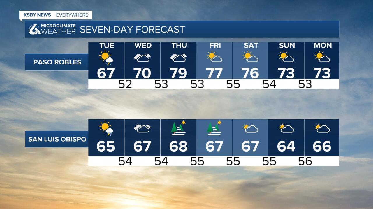
Temperatures will begin to warm slightly later this week to nearly 80 in the interior close to 70 at the coastal valleys beaches will remain in the 60s. For the coming weekend, temperatures look to again be cooler than average with daytime highs in the 70s and the interior mid-60s in the coastal valleys and 60s at the beaches.

Grab that raincoat, and have a wonderful day Central Coast!
