


Good morning, Central Coast! Happy Wednesday!
To kick off the morning widespread fog is sticking around thanks to the marine layer.

This marine layer will be very important through the day, with many beaches staying in the 50s while interiors surge to the low 90s.
Despite the relatively quiet forecast, we do have a 15 to 20% chance of thunderstorms in the mountains. This is thanks to the continued surge of unstable air pushed into our region from the desert southwest. This is the same set of of offshore winds that are pumping hot air into the interiors, resulting in our temps in the upper 90s.
Over the next couple of days the low pressure that has brought us this warmth will begin to loose steam, winds will calm slightly allowing the marine layer that has kept the coasts mercifully cool to spread its impacts inland. Each day temps will fall slightly through the weekend, it will still be warm but more manageable.
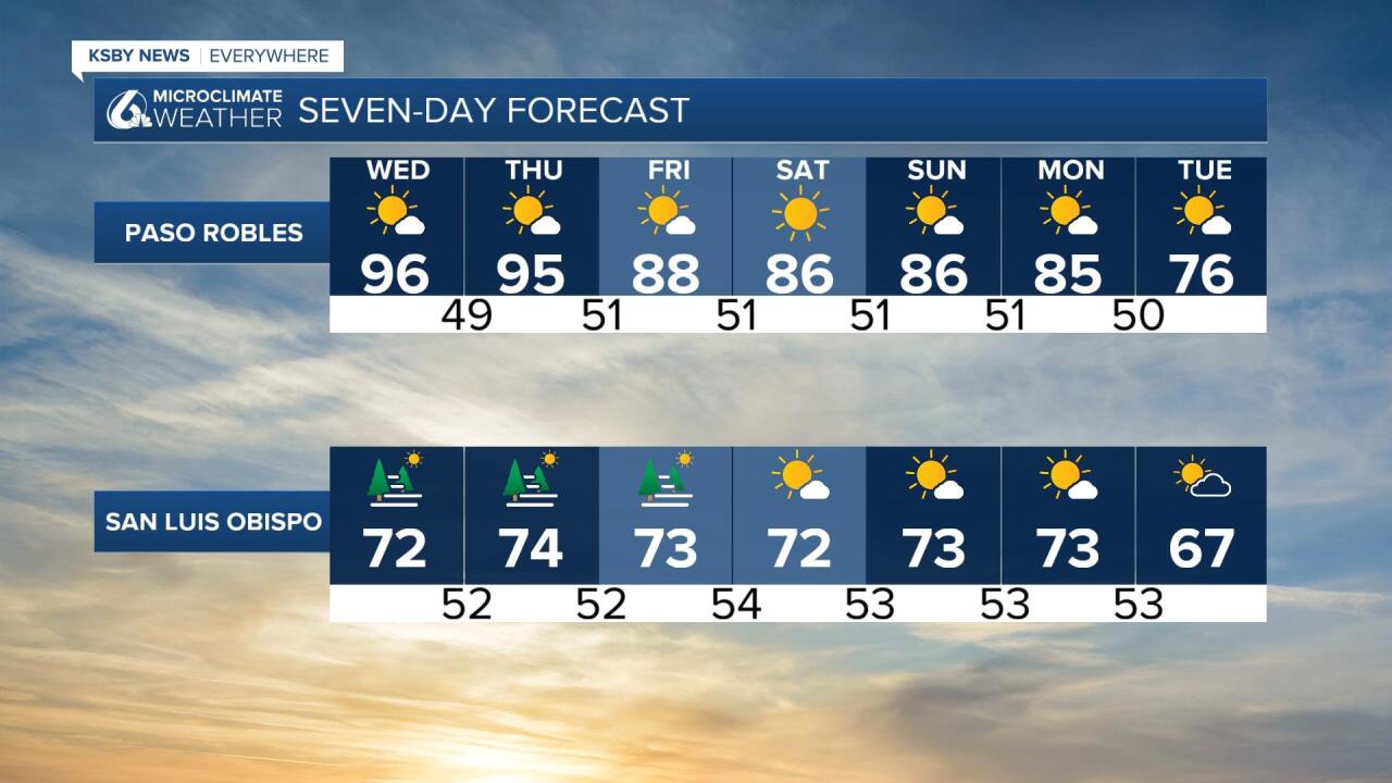

The weekend is looking comfortable for most with a slight warm up in our coastal regions. A more widespread cool down will move in early next week.
Have a great day!
