


Good morning, Central Coast!
To kick off our Thursday the marine influence is once again going to drop visibility for many communities at the coasts as well as in the Paso Robles area as a lobe of marine fog makes its way down the Salinas River Valley.

This marine layer cloud cover will continue to bring cool and dense air to the coastal valleys and help to keep temps low, especially compared to the extreme heat we have seen recently.
Enjoy the cooler air though, a big warm up is on the way. Before we get to that though, temps today will stay very much on the cool side. Paso Robles is only expected to reach into the mid 80s. For reference the "normal high" for this time of year is 94 degrees.
Coastal valleys will also stay below normal for this time of year, although to a lesser extent.
Asside from cooler temps today the winds are a factor, there are problematic sundowner winds along portions of the southcoast that are responsible fore a wind advisory in effect until 6 AM Friday for portions of the Gaviota coastline.

A high pressure is set to move into the region later today that will warm temps significantly, that will push interior valley temps back into the 105-plus range for the weekend. The good news about this inland heat spike is that it should end early next week.
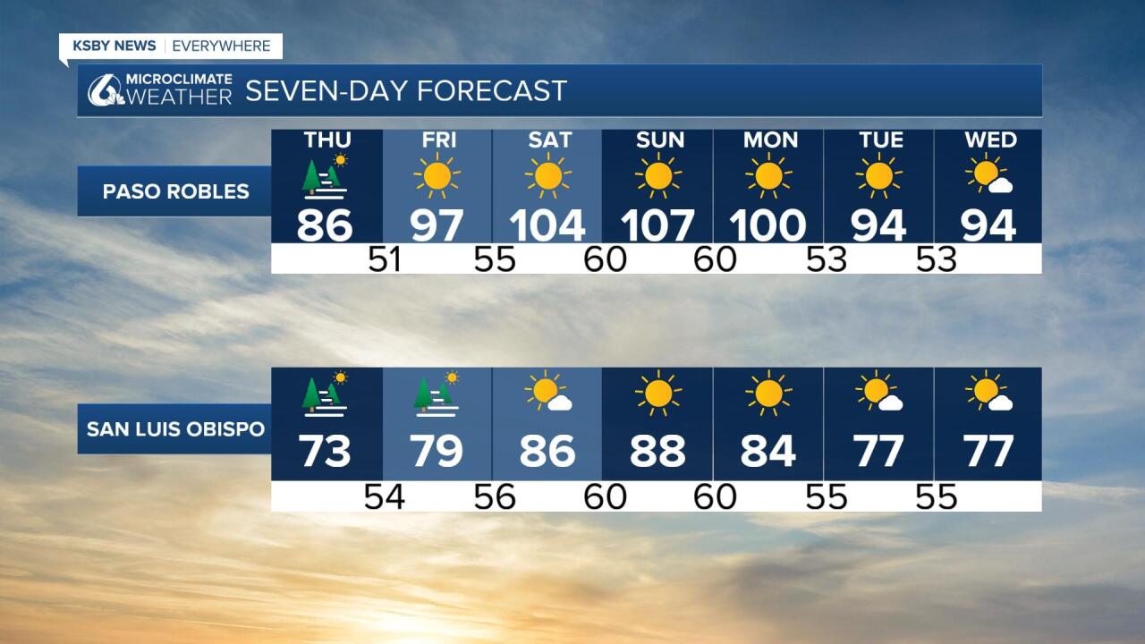
As for beaches and near coastal valleys mild weather will also continue for a couple of days before temperatures make a move this weekend. Coastal valleys like San Luis Obispo could see temperatures in the mid-80s to nearly 90 over the weekend while beaches should see generally 70s for highs and some other coastal valleys will be 70s to lower 80s.

Much cooler weather is expected by next week.
Have a great Thursday, Central Coast!
