


Good morning Central Coast! I hope everyone enjoyed the change of forecast for a little while at least because we are headed back to more "normal" condions over the forecast.
It wouldn't be a Central Coast forecast without starting with marine influence and fog. The difference though is that this morning the fog is patchy throughout all of the region with a few areas of particularly dense fog in the interior valleys. This is partialy helped along by the significant rain they saw yesterday increasing humidity.

Overnight low clouds rolled in and will stick around for the coasts but clear quickly as you move inland.
Today will be a sun-cloud mix with temperatures in the mid 60s by the beaches, upper 70s in our coastal valleys and low 90s for the interiors.
Monday night pop thunderstorms pushed through the region as wrap around moisture from Hilary moved through the region. These showers brought significant rain to the few spots that they moved over. So much so that a flash flood warning was issued for San Luis Obispo county Monday afternoon. This has since been expired but I think still interesting.
Looking at the hyper local nature of these storms some interesting rain totals came out of them. Highest elevations in Santa Barbara saw the most significant rainfall. Figueroa Mountain racked up two inches of rain from the thunderstorm.

SLO County's highest elevations also saw some rain with Rocky Butte racking up half an inch of rain.

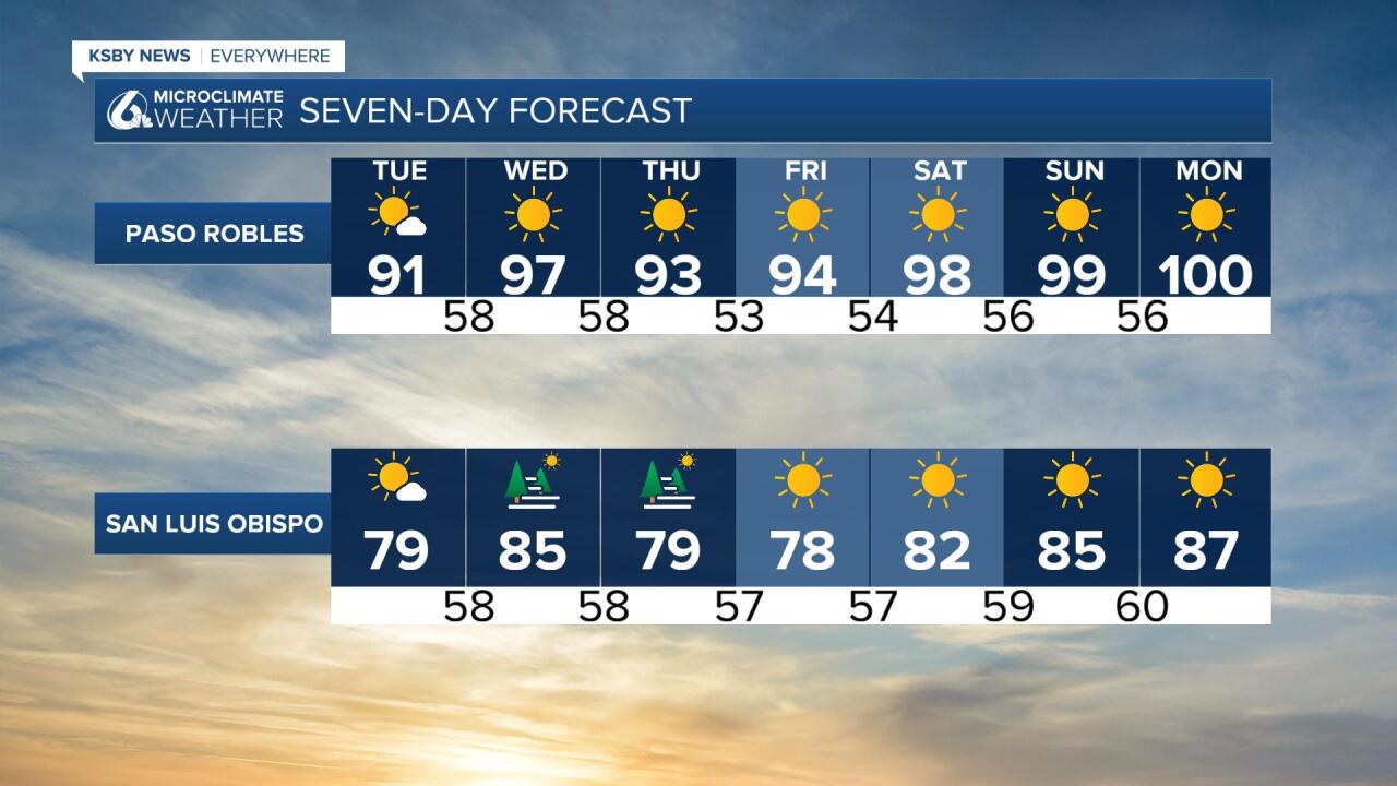
The extended forecast is showing typical conditions making a comeback. Warmer temperatures are expected to push into the interiors by Wednesday for a quick warm up. More significant (more than just one day) heating will take over by late week.

Have a wonderful day Central Coast!
