

Good morning Central Coast!
We made it to Friday and to the end of the significantly cooler than typical temps that have been the headline for the past few days. The northerly winds that pushed cooler weather into the region also brought all of the heavy smoke that has dropped air quality the past few days.
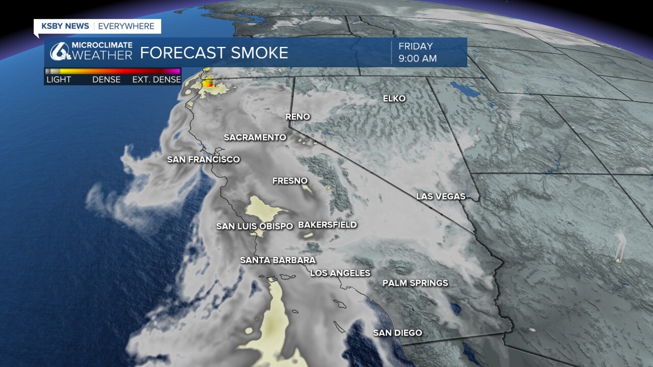
While we are going to begin to warm up today (thanks to winds beginning to shift to the south west) there is a lot more smoke to contend with. This is thanks to a large amount of smoke that had been sitting offshore over the past few days. While we have been on the edge of this smoke for days our winds have shifted and are now pushing the bulk of the smoke into our communities.

The air quality is hazardous to most at this point, please be cautious especially if you are in a sensitive group. The smoke will continue to pass through the region today, but thankfully no additional smoke is pushing in from the fires in NorCal. Once this passes clear skies are expected!
One small silver lining of all this smoke is that it is going to be a beautiful sunset across the region. If you capture a photo that you are proud of please send it to me by emailing it to Vivian.Rennie@ksby.com.
Other than the smoke temps are a bit more comfortable today than yesterday. Especially for the interior valleys where temps will raise nearly 10 degrees between yesterday and today!
As the upper low begins to kick out on Today, marine depth should begin to decrease a little bit as well. So while I'm talking about warming It won't be that dramatic. In fact, it might not be that noticeable at beaches and coastal valleys while being most notable in the interior.
Today beaches will see daytime highs generally in the 60s with 60s and low 70s in the coastal valleys with upper 70s returning to the interior. Interior temperatures continue to warm over the weekend recovering back into the 80s.
After the weekend I expect temperatures to continue a small warming trend with mid to upper 70s returning in the coastal valleys next week.
Beyond the seven day, I expect temperatures to generally stay cooler than average as a series of systems look to impact the Pacific Northwest. While I don't expect local significant rainfall our proximity to the storm pattern we'll keep the temperatures well in check if not below average.
Have a wonderful day and weekend Central Coast!
