Good Morning Central Coast!
We have significant high pressure sticking around in the region to start off this week. Aside from high temps our big impact this morning is fog continuing to moderate temperatures along the coastal regions.

Our marine layer is about 1000 feet in thickness, that allows it to move into the coastal valleys but is stopped by our mountains and passes at any elevation above 1000ft.
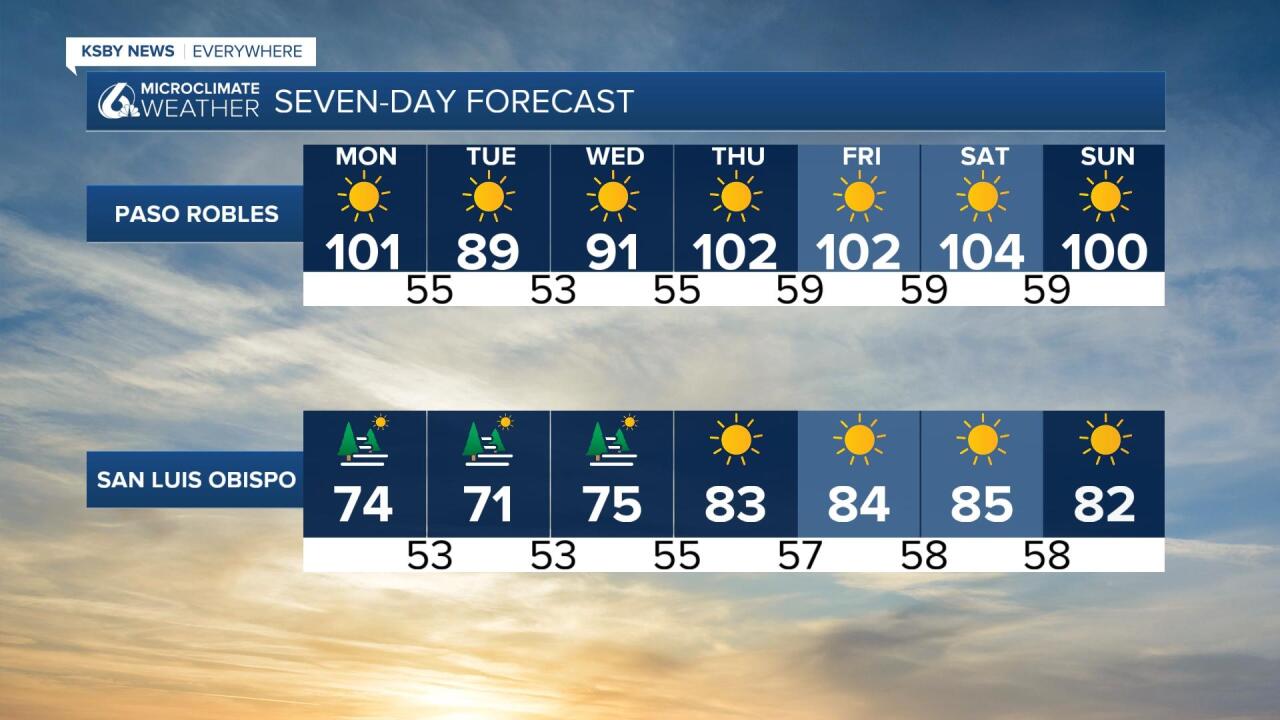
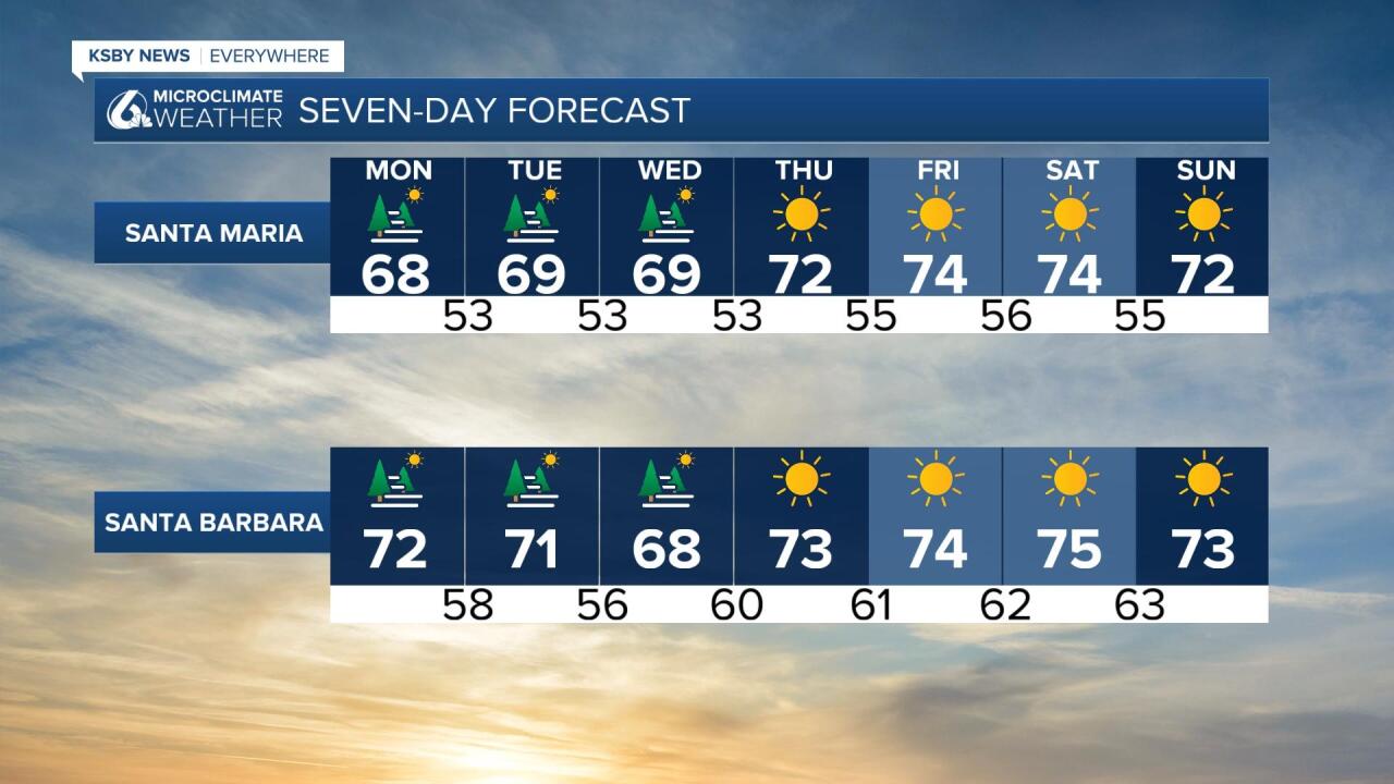
The marine layer is going to keep us much cooler along the coasts for today, highs into the triple digits in the interiors today. Paso Robles and the eastern portions of San Luis Obispo county will be dangerously hot. There is a heat advisory in place for portions of the central valley and while this advisory doesn't extend into the Central Coast, similar dangerous heat is expected. Take caution when in the heat.

Into the next few days we will see a bit of a roller coaster in the interior valleys. Tuesday morning's marine layer will extend higher into the atmosphere enough to extend into the interior valleys. Highs will drop about 10 degrees because of this where the marine influence extends to. Locations without the slight additional marine moisture will still climb to the near triple digits while valleys with that cooler air will be cooler and more comfortable.

Wednesday temperatures will stay on the cooler side once again for the interior valleys but by Thursday heat will build in again, many days above 100 degrees are possible.
Coastal locations and beaches will remain mild and close to normal though the next 7 days.

Looking into the extended forecast, more heat is expected for the next new days even after the 7 day forecast ends.

Have a great day Central Coast!


