


-High pressure aloft will keep a warm and dry weather pattern in place for communities away from the coast through this weekend.
-Low clouds and fog, locally dense, will continue near the beaches each night and early morning.
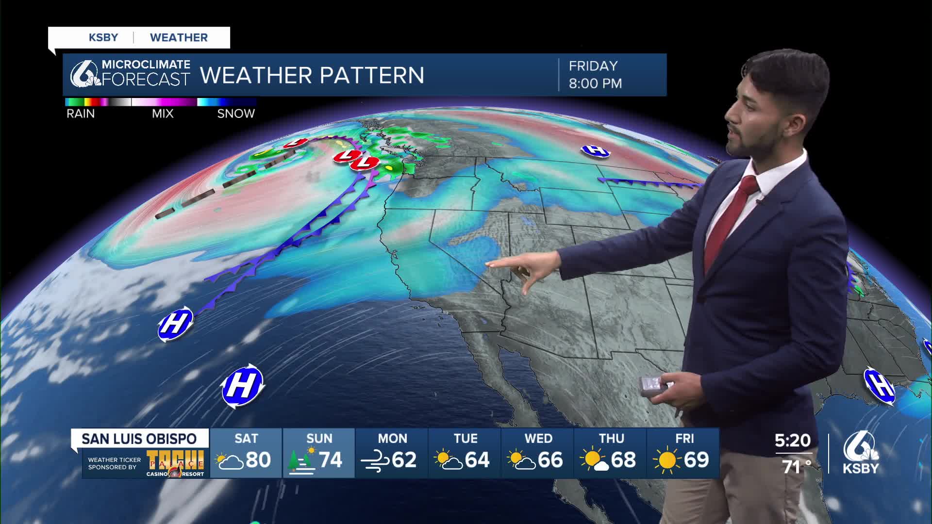
-A large and strong weather disturbance will bring a significant change to the weather pattern in our region, with strong winds and much cooler temperatures expected for early next week.
-Drizzle or even areas of very light precipitation will be expected late Sunday through early Tuesday.
Detailed forecast:
Low cloud and fog development will occur later this evening, and areas of dense fog are forecast from late evening into early Saturday morning.
Once again, the risk of dense fog will be rather high due to a strong and shallow marine layer still in place along the coast.
Due to the shallow nature of the inversion, very low visibilities could be encountered late tonight into early Saturday morning.
A shallow marine inversion is likely to stick around through the weekend.
More dense fog will likely plague the coastal areas, with clouds possibly hugging the coast each day.
There is a small chance that a developing high-level cloud deck could play tricks on the marine layer and break up the low cloud field.
Heights continue to climb into Saturday as the ridge continues to amplify with an upper-level trough, but the ridge axis will move east of the area, and southwest flow aloft will increase on Saturday.
A dirty ridging pattern could develop on Saturday as cirrus blow off from the broader trough circulation and Hurricane Kristy combine to make for a mostly cloudy period between Saturday and Sunday.
The forecast ensembles produce mostly cloudy to cloudy skies across the region between Saturday and Sunday. This, with a slight increase in the onshore pressure gradients due to increasing southwest flow aloft, will bring a few degrees of cooling each day.
Thickening mid and high clouds will be more pronounced by Sunday due to remnant moisture from the remnants of Hurricane Kristy, currently located over the eastern Pacific basin, but forecast to become extra-tropical late Saturday or early Sunday.
Have a fabulous weekend, Central Coast!
