


Good morning, Central Coast and happy Friday!
As we kick off the morning there is going to be some light marine cloud cover for western beaches. That will clear out very quickly and abundant sunshine is expected for today.

The last few weeks it has been all about the extreme heat and there are still a few more days of 100+ degree days before a much deserved cooldown in the interior valleys early next week.
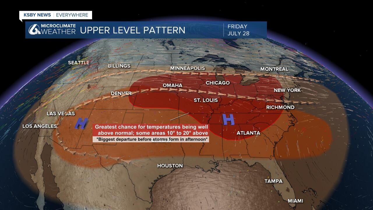
We aren't to the cooldown yet though, the high pressure that has dominated our forecast has moved east and is now bringing extreme heat to the Midwest and the East Coast. There is some lingering high pressure over us still, that will continue to extend our hot conditions and keep the heat records updating daily in Phoenix.
Highs today will be hot in the interiors with yet another 100+ degree day. Even the Santa Ynez Valley will be in the upper 90s.
Thankfully coasts will be more comfortable but still a few degrees above normal for this time of year.
Coastal valleys will actually see temperatures increase as we get into the weekend with some coastal valley temperatures in the mid to upper 80s All other coastal valleys like the Santa Maria valley should see temperatures in the mid-70s to nearly 80 degrees. South Coast temperatures should be in the upper 70s on Friday and in the low 80s over the weekend.
Beaches will generally see temperatures in the 60s and 70s over the next three days with a variable amount of marine cloud cover mostly during the night and morning but clearing in the afternoon.
For the last few days of the California Mid-State fair triple digit heat will continue, continue to take the common sense precautions and stay aware of heat related illnesses.
The pattern producing the current warmth in the area is a ridge of high pressure that the Central Coast is on the western periphery of. Next week that Ridge gives way to a trough of low pressure which will deepen the marine influence and onshore flow causing temperatures to back off.


The cooler weather may not last for too long. The Climate Prediction Center’s 8 to 14 day forecast still calls for above average temperatures during that time frame. That is likely based on another ridge backing into the California from the east. This should boost temps going into the first weekend of August, but this ridge doesn’t look to set up for long. Models are showing a couple warm days before some activity in the Pac NW flattening the ridge and cooling temps again.
Have a wonderful weekend Central Coast!
