

While temperatures have likely peaked, interior valleys will see well above normal temperatures throughout the week, while the marine layer will moderate coastal temperatures and a moderate to strong onshore flow.
A very shallow but significant marine deck of clouds greeted the Central Coast this morning, and where the clouds formed, they have been stubborn. "Shallow" means the vertical extent of the marine clouds was less than 750 feet, meaning it didn’t get far inland. Temperatures overhead are warm, so the inversion cap on those clouds is strong, hence the slow clearing.
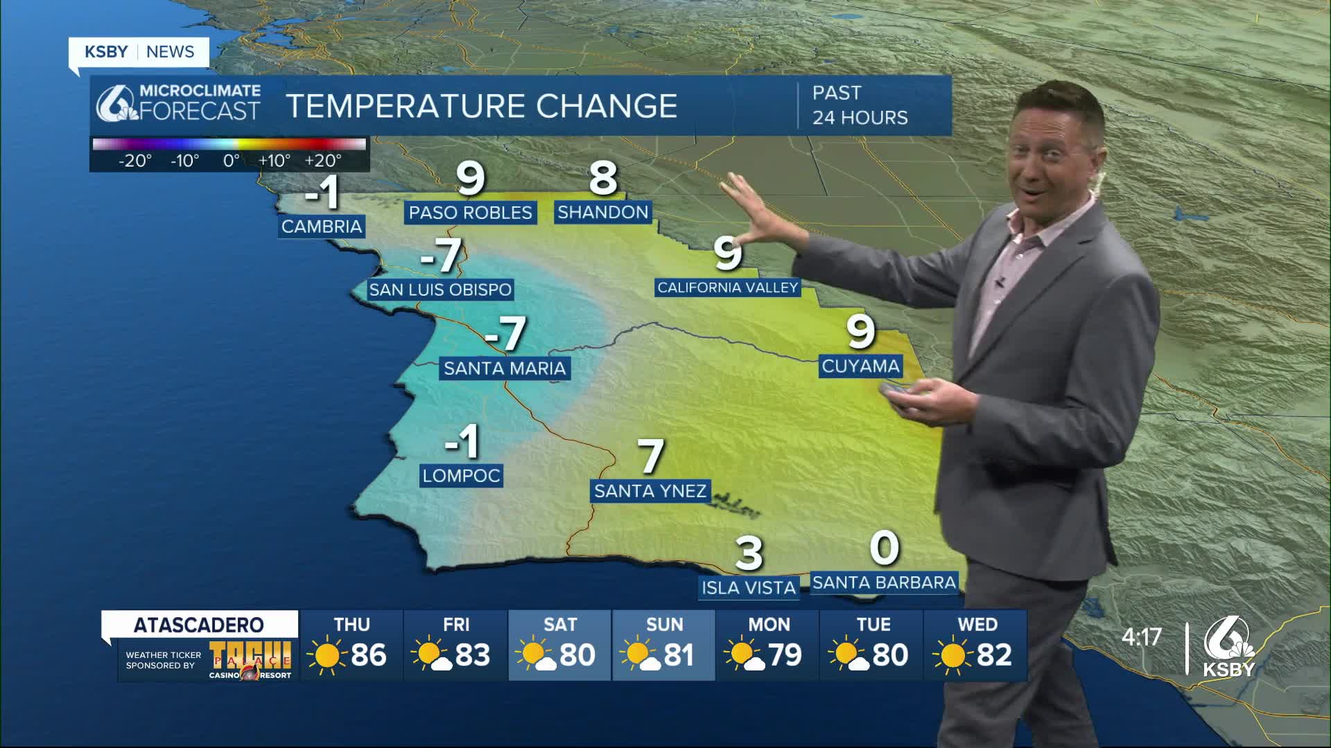
Interior areas of San Luis Obispo and Santa Barbara counties are under heat advisories, and despite some expected cooling on Thursday, the advisory will continue through 8 PM.
Here is what you need to know about the heat advisory: A Heat Advisory remains in effect until 8 PM PDT Thursday for the Cuyama Valley, San Luis Obispo County Interior Valleys, and the Southern Salinas Valley, including Lake Nacimiento, New Cuyama, Atascadero, Mill Creek, Paso Robles, Creston, San Miguel, Templeton, Shandon, Cuyama, New Cuyama, and the Carrizo Plain. Temperatures are expected to reach up to 100 degrees Fahrenheit. Residents are advised to drink plenty of fluids, stay in air-conditioned rooms, avoid direct sun exposure, and check on relatives and neighbors, as hot temperatures may cause heat-related illnesses.
Today is expected to be the warmest day of the next week. Offshore trends produced a weaker seabreeze, contributing to today's high temperatures.
The ridge will weaken slightly on Thursday, but not enough to cool the interior, where heat advisories and warnings will continue. Coastal and valley areas will cool as onshore trends return. Mid-level moisture arriving from the south brings a slight chance (around 15%) of showers or thunderstorms over the higher mountains of Santa Barbara County, though some models do not show this at all.
The ridge will further weaken on Friday, increasing onshore flow. This will keep morning low clouds stuck to west-facing beaches. Maximum temperatures will cool by 3-6 degrees across the board, bringing the interior to about 8 degrees above normal, while coastal and valley temperatures will return to normal daytime highs.
Long-Term Forecast (Saturday - Tuesday)
The weekend forecast shows good confidence in a June Gloom pattern, with a saggy trough overhead and strong onshore flow from an East Pacific surface high. Expect the night through morning low cloud pattern to extend to the coastal slopes, with slower than normal clearing and no clearing at many west-facing beaches. Temperatures will cool each day, with the most significant drop expected on Sunday as heights fall.
For Monday and Tuesday, expect persistent night through morning cloud patterns, slightly below normal coastal temperatures, and slightly above normal temperatures across the mountains and far interior.
