

Good afternoon Central Coast! We got to enjoy a nice Sunday with slightly cooler in those coastal valleys but warmer in the north coast and interiors.
The high for San Luis Obispo and Santa Ynez was 82 degrees. For Paso Robles and Santa Barbara, the high was 79 degrees.
Although temperatures were still on the warmer side, we saw some low clouds linger along the coast and coastal valleys.
Our winds were pretty mild on Sunday. Breezy conditions were seen in Santa Ynez and Santa Maria with peak wind speeds between 18 and 22 mph.
As we head into the work week, we can expect those cloudy and foggy conditions to gradually increase.
Another change in our forecast is a cooling trend that is bringing our temperatures down across the board.
Beaches are dropping to the low 60s, coastal valleys to the upper 60s and interiors to the 70s. These changes will roll into Tuesday keeping those temps mild and cool.
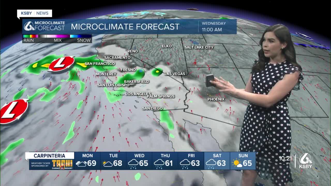
This is a transition period leading into a multi-day rain event that becomes more likely mid-week.
Models are still pointing to Wednesday as the day this weak atmospheric river makes landfall.
Our atmospheric river model shows a transition from dry to humid conditions starting on Wednesday. According to this model, the system seems to stick around through Saturday.
Our Extended Forecast Rainfall model also agrees with Wednesday as the day to keep an eye on. This model shows that low pressure system developing in the Pacific and gradually making its way to California.
We can expect several waves of light to moderate rain starting on Tuesday night. For San Luis Obispo County and Santa Barbara County, models are pointing at rain likely happening on Wednesday through Friday. Rain is still possible Friday night and Saturday morning and less likely on Saturday night.
How much rain we could see? The National Weather Service is estimating we could see 1” to 3” of rain.
Most concerns of flash flooding are directed to burn scars and urban areas because it is expected to be a long rain event.
Our seven-day forecast is now including rain icons until Saturday. Our temperatures will be in those low to mid 60s for the most part. Santa Barbara could drop to the upper 50s on Thursday. Lows are staying mild across the board.
Again, take precautions ahead of this rain event. Check your wipers, get sandbags and be aware of potential flooding in your area.
Stay safe everyone!
