

Hello, Central Coast! The Excessive Heat Warnings and Heat Advisories are still in effect for the interior communities on the Central Coast through Sunday night. As a precaution, please be weather-aware, limit your exposure to the sun, and be sure to hydrate this weekend, as warmer conditions will continue to impact our interior valleys and some coastal valleys.
Weather headlines:
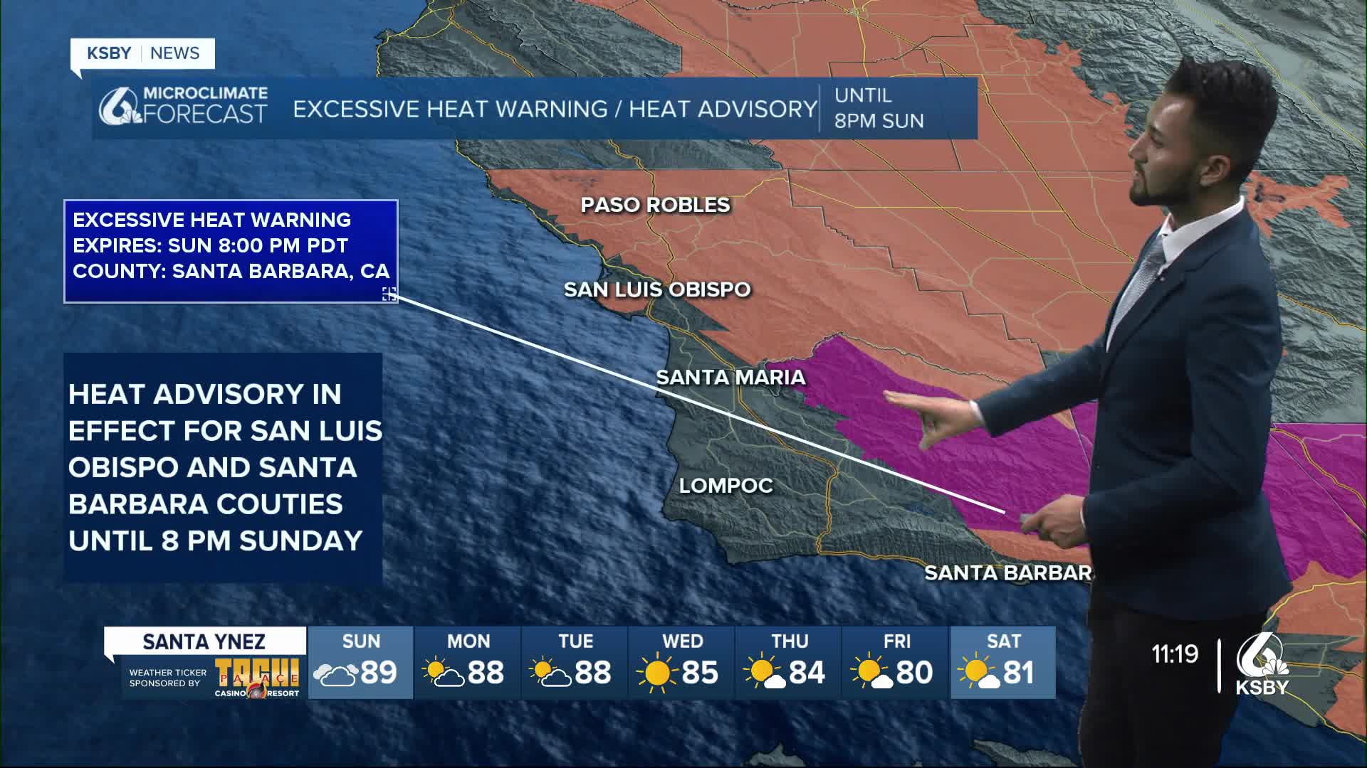
-Excessive Heat Warnings and Heat Advisories are in effect for communities away from the coast this weekend, as dangerously hot conditions impact interior areas.
-There will be a gradual cooling trend over many locations during the upcoming week.
Extended forecast:
High pressure is dominating the region this weekend. This will lead to rapidly rising temperatures across the Central Coast's interior areas.
As midlevel heights rise this weekend, temperatures will increase to dangerously hot levels from in the Santa Barbara County interior mountains.
The Excessive Heat Warning is in effect for Santa Barbara County's interior mountains until 8 p.m. on Sunday.
For communities away from the coast, the heat risk will be relatively lower compared to those in Excessive Heat Warning areas.
A Heat Advisory is in effect as potential heat impacts are anticipated, with moderate to major heat risk. The Heat Advisory for San Luis Obispo and Santa Barbara Counties is in effect until 8 p.m. on Sunday.
High temperatures in the Heat Advisory areas may reach in the 90-100 degree range this weekend.
High Temperatures for Sunday:
Coastal Valleys will see high temps ranging between the 70s, 80s, and possibly in the 90s near the Santa Ynez Valley.
Interior Valleys will see temps in the 90s and 100s.
Beaches will range between the 60s, 70s, and 80s.
The diurnal erosion of the marine layer will cause its cooling influence to retreat closer to the immediate coast each day this weekend, resulting in a broader area of significant heat impacts.
For locations near the coast, temperatures will be relatively cooler given the influence of the marine layer. Within the shallow marine layer, areas of nighttime and morning dense fog are expected near the immediate coast and nearby coastal valleys through early next week.
Have a great day, Central Coast!
