


Good morning, Central Coast!
Monday was a bit of a mixed bag for the region as we began to transition from the hot and muggy weekend to a much more mild week, plus we got some showers mixed in there too.
Highs still climbed into the 90s in the interiors, 70s in the coastal valleys and 60s at the beaches.

This was significantly cooler than Sunday for much of the region, and we will continue this trend for the next few days as we transition to a much more "typical" forecast for the Central Coast.

Although no advisory is in effect, Sundowner winds are expected to pick up once again tonight in the Santa Ynez Range with gusts of 25 to 40 mph. The Gaviota Pass could also see winds gust up to 30 mph.
Over the next couple of days temps will fall a little more and bring in even more morning marine layer. By Thursday the morning marine layer will be deep enough that the interior valleys will see morning fog. This will keep temps down but still sunshine is expected in the afternoon.
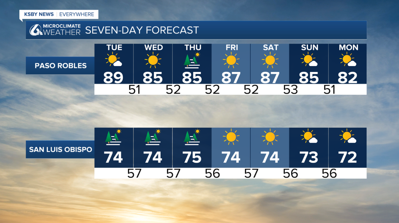

Through the 7 day forecast conditions will stay beautiful with abundant afternoon sunshine. Temps will even creep to a couple of degrees below normal for this time of year by later this week.
Have a wonderful day Central Coast!
