


Good morning Central Coast, we made it to Friday!
To kick off the morning there is a lot of marine influence to contend with across many coastal valleys and all of our Western beaches. This has dropped visibility towards 0 miles across portions of the region.
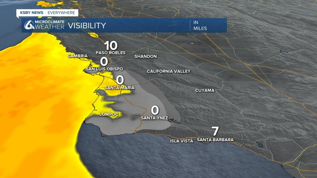
Those low visibility values are enough to prompt a dense fog advisory for the western beaches and some coastal valleys through 9 a.m. this morning.

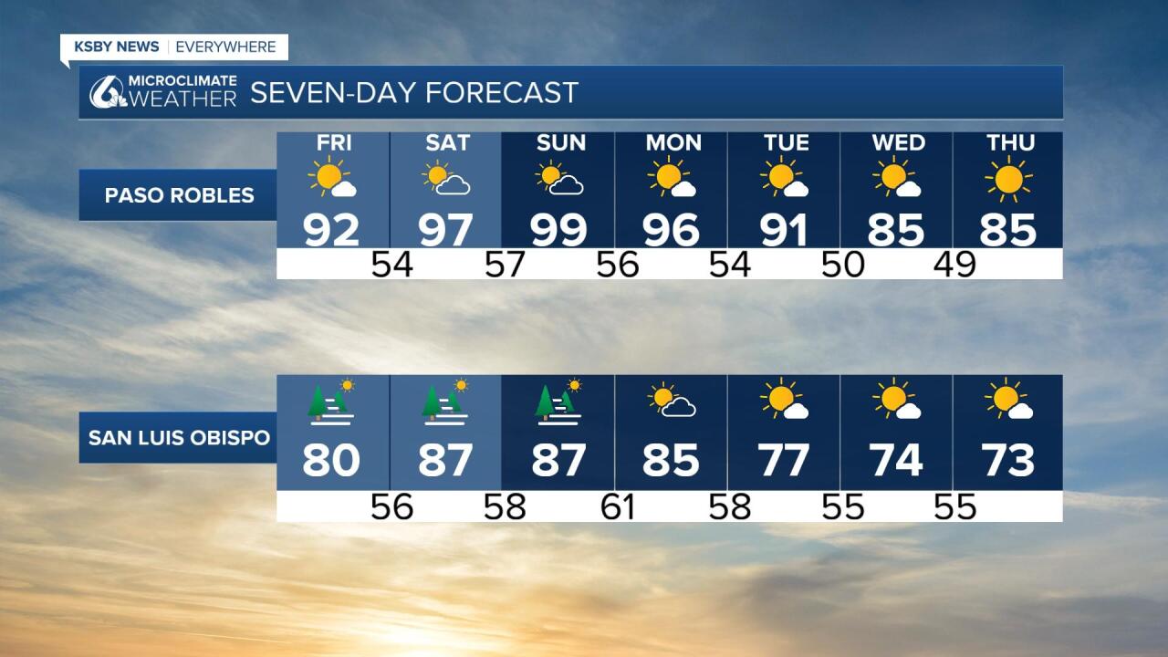
Thanks to the marine influence temps today on our beaches will be mild without too much of an increase. For the interior valleys it is a different story, without cooler marine air interior valleys will surge into the nineties.

As we continue into the weekend temps will continue to increase everyday, we may even reach the triple digits in some communities this weekend. This is all thanks to a high pressure system sitting to our east bringing extreme heat to much of the desert southwest. Here on the Central Coast it means marine influence confined to the beaches, offshore winds and sunshine.

That high pressure is not the only driver in the forecast, it is time to once again look to the tropics as high clouds and added humidity move in from the south. These high clouds are related to hurricane Jova which is South and West of Cabo San Lucas in the Eastern Pacific Basin.
Currently, Jova is a weakening category 2 . The track of this storm will continue to take it to the West further away from the West Coast. So, if it's getting further away how is it possible to have showers relating to an exiting system?

The answer is that the upper-level winds from the southwest will be shearing the north side of the system tearing off some upper-level moisture and potentially bringing it to California.
We are not talking about anything major in terms of rainfall potential more so the fact that it's just possible Saturday through Monday as a stream of high clouds pushes over the Central Coast into the Central Valley. The best way to refer to the potential is likely isolated rather than scattered or likely.
While showers are possible but quite unlikely we will see increased wave heights as well as an increased risk of rip currents. Due to this risk a beach hazard statement has been issued for all Central Coast beaches through Monday at 5 p.m.

The warm weekend weather continues into Monday, but temperatures start to dip Tuesday through Thursday with interior temperatures dropping back into the mid-80s by midweek with coastal valleys returning to the 60s and 70s and beaches to the 60s.

Have a wonderful weekend Central Coast!
