
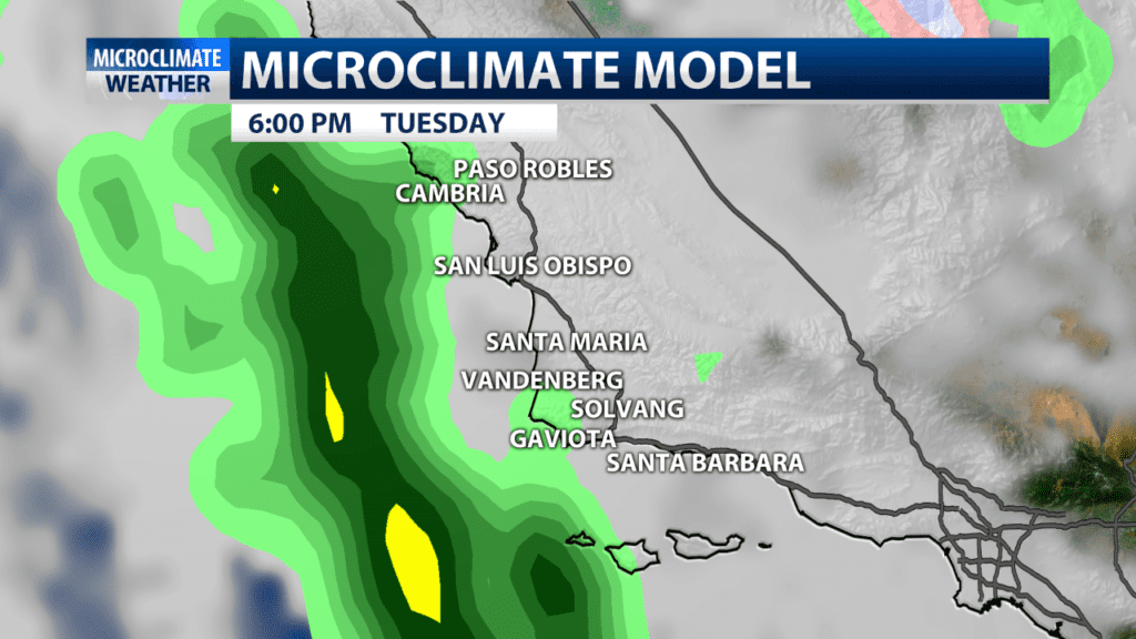
The Central Coast has enjoyed a nice run of dry weather but rain looks to return this week. A low pressure system looks to cut off just off the Central Coast for rain as early as late afternoon but more likely after sunset and lingering thru Wednesday.
Showers are even possible early Thursday before dry weather resumes Thursday and Friday.
Models show potential for more rain later Friday or early Saturday then a brief break before a third potential system Monday and Tuesday of next week.
In terms of this first storm. Winds will pick up later Tuesday into Wednesday at 15-25mph out of the south with .25-1.00″ in SLO county .25-.75″ in northern SB county with light to .25″ in southern SB county.

There is a slight chance of thunderstorms in higher elevations since there is cold air aloft associated with the system. The heaviest rains don’t look to take place over burn areas so no advisories are anticipated. However the activity will cool the high temps a lot, by Wednesday we are back to 5-10 degrees below average again. Snow levels with the first torm start near 6500 and drop to about 5000, not a local concern for travel but it could be for the I-5 Grapevine.
