There is still a little more time with dry weather before rain returns. Most of Tuesday is a transition day as the storm draws closer. Slowly, the clouds will build and the southerly winds ramp up, but no rain is expected during daylight hours on Tuesday. Rain holds off until after midnight for most (with the exception of the SLO north coast, where it arrives earlier).
On Tuesday night, the winds will pick up to 15-25 mph with gusts past 35 mph out of the south. The rain will be most intense overnight but linger as showers through Wednesday and potentially into early Thursday, as well. 0.50 to 1.25 inches of rain is possible.
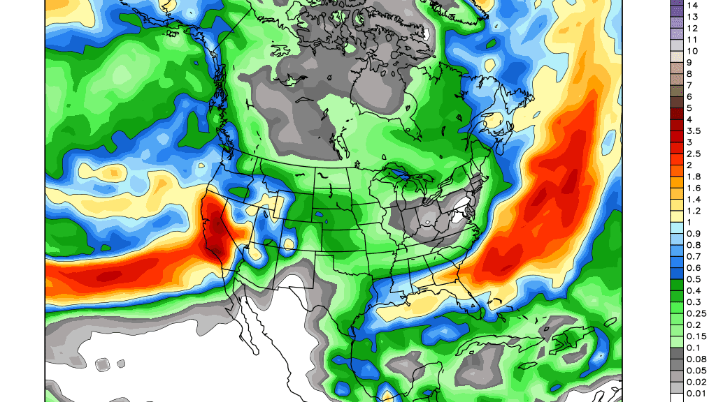
Later Thursday into Friday looks like an important break because a stronger low-pressure system will tap into an atmospheric river and will produce strong southerly winds and heavy rain on Saturday. Total rainfall amounts on Saturday could be as high as 2 and 3 inches. Scattered rain looks to continue Sunday.
Models are showing more potential midway through the following week as well, with another well-connected storm capable of more moderate to heavy rain. Looking into mid-month, the pattern could remain active.