
A low pressure system and cold front is arriving on the Central Coast and it is indeed a cold system. This will mean low snow levels, perhaps as low as 1500ft at times and on and off showers into Thursday afternoon.
Could snow even hit the valley floors? Yes, it could but the best chance of it sticking is at elevations above 1500ft. For instance Paso Robles is 732ft. in elevation but the Cuesta Grade is 1522ft.
This potential for low level snow means Highways: 41, 46, 58, 154 could all see locally tricky and slippery travel conditions.
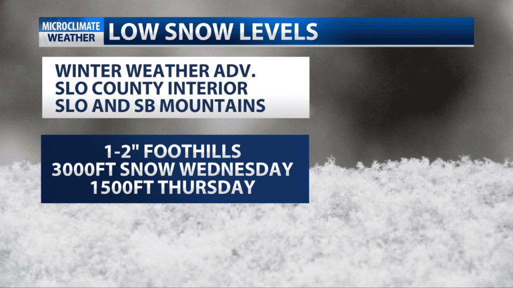
I think we’ll see less than .40″ of rain from a system that is mostly showery. That said, there is the possibility of occasional small hail with the system as well.
Breezy NW winds are also developing: 15-25mph for most of the coast with some higher gusts.
Offshore winds and dry conditions are expected for the weekend but temps stay on the cool side with it being a struggle to hit 60.
We could see a shower chances the middle to late next week.
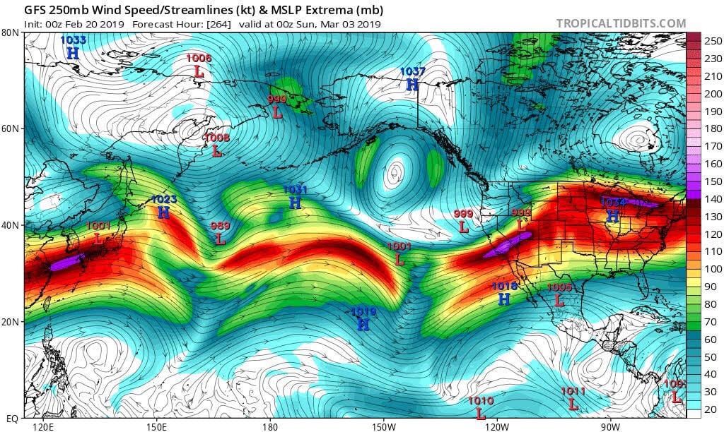
This is a picture of a model output of the possible position and strength of the jet stream in early March. It shows a strong 150kt+ jet right on the Central Coast. The jet stream is the river of high altitude wind that steers storm systems.
Around the 2rd-4th we could see a possible connection to subtropical moisture, the so-called atmospheric river. If all this aligns this could mean a wet start to March. Models are indicating more activity after this but the question is where would it all hit, north of here or a more direct route? Bears watching but the door looks to be open to more significant activity.
