
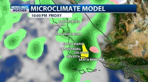
Two cold but generally weak low pressure systems will roll thru thru the Central Coast between now and Monday. The system Friday night into Saturday is cold and also unstable so showers could include isolated thunderstorms and hail but the rain amount should be limited due to lack of low level moisture. I think most locations will see light to .75″ of rain, higher elevations could see more.
There is a winter weather advisory in place for the SB county mountains as the snow level will drop to about 3500ft. 1-3″ of snow is possible. The larger issue could be snow and travel over the Grapevine since 6″ is possible above 5000ft.

There looks to be a gap in showers from Saturday afternoon thru the evening but the second storm system should arrive late Saturday night into Sunday morning. It looks to deliver less than .50″ of rain but snow levels could be even lower, down to 2500-2000ft by Sunday morning.
Monday and Tuesday look dry then Wednesday through the following weekend looks active. Models are struggling with the details of this period but agree that it is generally unsettled. We’ll refine this forecast as we move forward. People should stay informed as several outlooks have featured inches of rain.
