
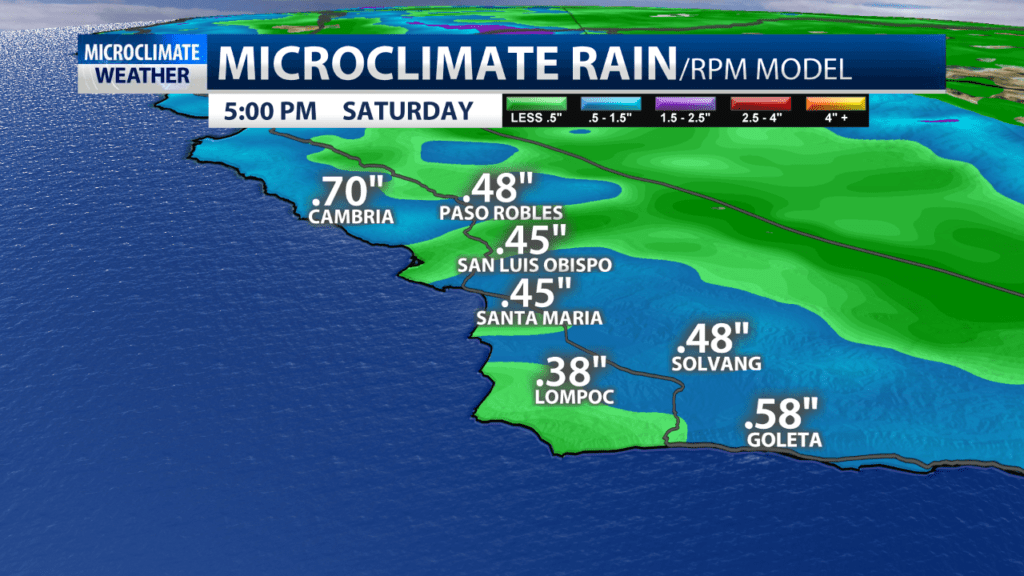
We have been stuck in a cool and unsettled pattern. That pattern delivers another cold front Friday afternoon into Saturday morning for rain up to .75″ and snow levels down to 3500ft.
There looks to be a small break Saturday afternoon into evening with another front late Saturday night into Sunday. That system looks to drop less rain, likely less than .50″ however snow levels could drop as low as 2000ft.
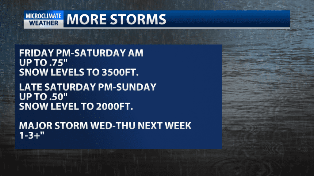
Monday and Tuesday look dry but then all eyes are on a larger system possible Wednesday and Thursday of next week.
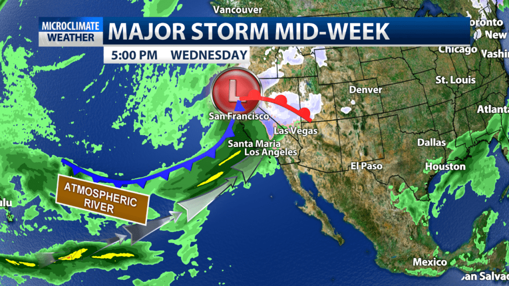
That system could tap into the sub-tropical atmospheric river and deliver 1-3″ of rain, and possibly more. This would again be a concern for burn areas and development of the storm will have to be monitored carefully. Wet and unsettled weather is expected to continue next Friday into next Sunday.
