
Our brief break in the rain is about to end. A storm system will arrive later Tuesday night into Wednesday. The system will draw up some southerly wind and produce some rainfall however the cold front associated with the system looks to dissipate over the Central Coast limiting the total rainfall.
Inland locations and southern Santa Barbara county look to see the least rainfall with totals likely under .30″. Most coastal locations look to have .25-75″ rainfall.

Thursday another brief break before rain returns Friday into Sunday when 2 more systems arrive back to back.
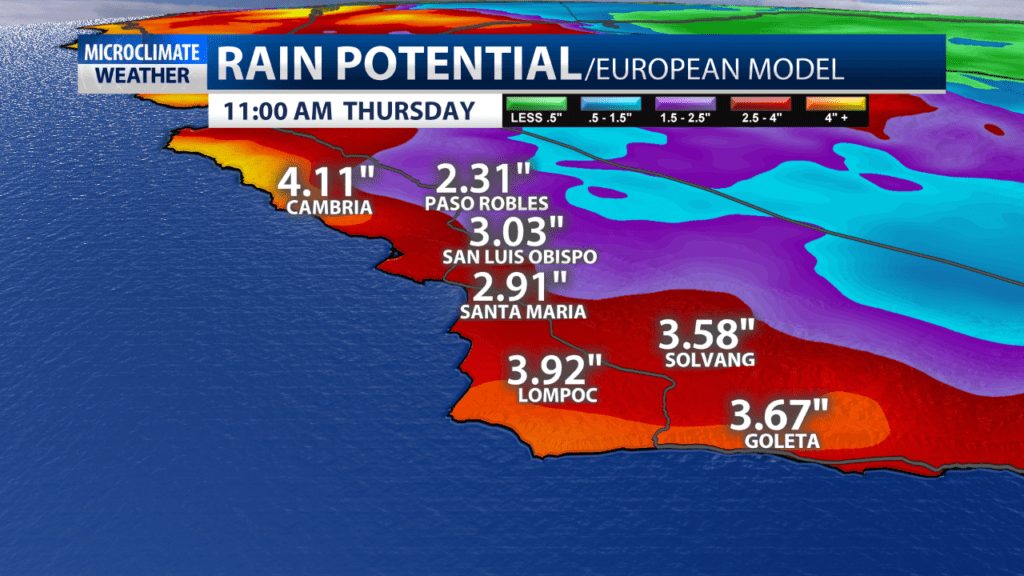
Right now it looks like another .5-2″ is possible with an even larger event possible the middle of next week. Cumulatively between now and the middle of next week 1-5″ of rain could be possible.
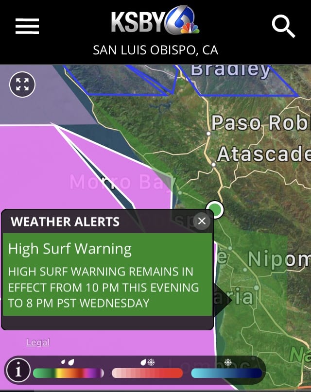
The activity has also created big swells. There is a high surf warning for the Central Coast for surf between 17 and 22 feet with sets to 26 feet are expected at west-facing beaches during the peak of the surf event on Wednesday. Surf will likely subside through Wednesday night and the warning will likely be converted to a high surf advisory. The high surf will likely continue through Thursday.
