
A storm system will move across the area today through Thursday, bringing significant rainfall and gusty winds to the area. After a lull on Friday, another, weaker storm system will move through on Saturday, bringing a chance of additional rainfall. Temperatures will remain below seasonal normals through early next week.
The first part of the storm moved through the area this morning with generally light rain but the main part will still arrive later Wednesday and linger into later Thursday.
The first part of the system involved a weak cold front the second part of the system has strong SW wind flow in advance of a more powerful low and associated cold front.
Rain rates with the main band of the storm will pick up a bit to .30-.50″ per hour at times. This is something to watch carefully at new burn areas in Southern California but locally those rates are likely just just low enough that the Thomas Fire burn scar is not considered to be at risk of a debris flow. That said, people who live near any recent burn areas should stay in touch with the latest forecasts and register with local agencies to receive emergency information.
Most of the rain will not be thunderstorms however a small risk of those creeps into the forecast Thursday afternoon when the colder unstable air behind the second fold front passes over the Central Coast. Rainfall around thunderstorms can come down quickly, but again this is a minor threat at this time.
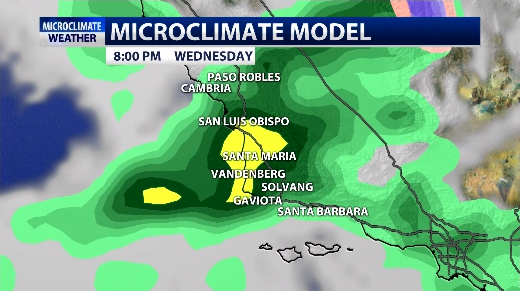
In terms of of rain potential: Rainfall amounts should see at least .75″ with the vast majority seeing 1-2″. Upslope areas 1.5-3″ and the extreme portion of NW SLO County near Hearst Castle as much as 4″. Peak rain activity looks to be Wednesday night into Thursday morning with rain ending Thursday evening/night.

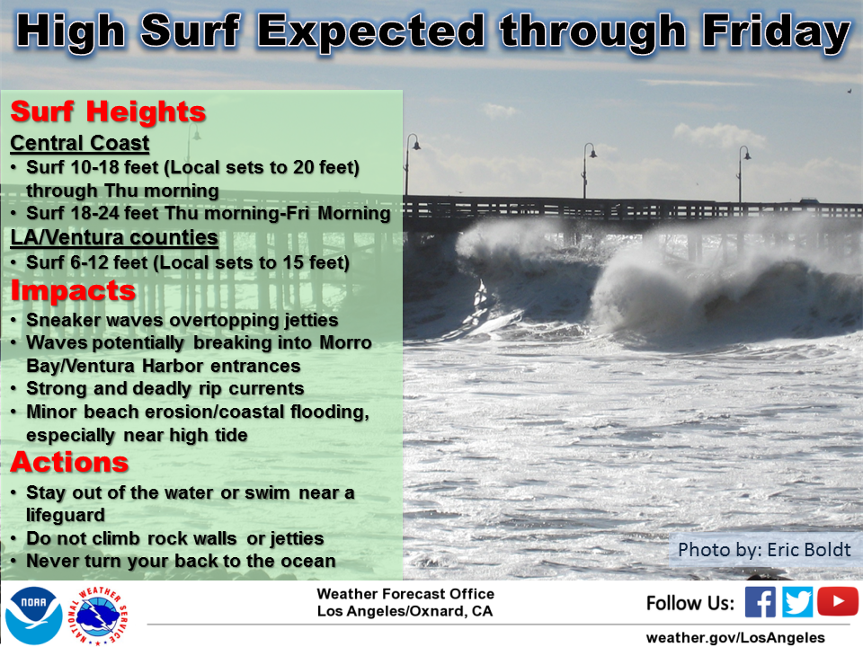
Waves are huge with a high surf advisory upgraded to a high surf warning into Friday. Thursday into Friday some of the peak surf could be 18-24ft.
SW winds also will pick up later Wednesday PM into Thursday. SW winds 15-30mph with gusts to 40 will accompany some of the heaviest rainfall.

Friday looks dry with the NW flow behind the storm, but around 5-10 degrees below average for highs.
Saturday should see a few more showers over SLO county and another generally cool day. Early next week looks quiet with another ridge trying to develop but temps may still lag a few degrees below normal.
The door looks open to more weather next week, potentially as early as Tuesday or Wednesday with another system on its heels.
