
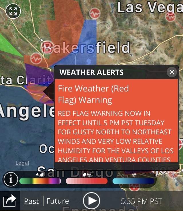
Offshore flow has dominated California weather over the last couple days with devastating results. That will continue into early next week. The pace of the winds will slow a bit tonight into tomorrow but an invigorated offshore event picks up Sunday morning-Tuesday. Across Southern California the Red Flag Warnings have been extended into next week.
The dry air and clear skies (other than some smoke haze) will result in very cold overnight lows in the SLO county interior. The Freeze Warning has been upgraded to a Hard Freeze Warning since some of the overnight lows have potential to drop into the mid-20s.

The warning lasts until Sunday morning however I think freezing mornings are possible all 7 days in the forecast for the northern SLO county interior. Some patchy frost is possible elsewhere in the area, including some of the coastal valleys in SLO and SB county.

Low 70s for the beaches, mid 70s and low 80s for high in the coastal valleys and mid to upper 70s in the interior valleys in the extended forecast thru next week.
As I have been saying for a few days now, I like a pattern change to a wet pattern after the 15th. Models again show a showery system on the 17th and a more significant system around Thanksgiving and another after that to end the month.

Still speculative since it is in the far extended but multiple models show the potential and ensemble models which are used to assess confidence. I will keep you up to date about the long range rain potential.
