
High pressure is going to drive some dry offshore winds across the region. The strongest winds will be across Southern California. LA, Ventura and a number of other counties have Red Flag Warnings and Wind Advisories in place due to the 30-50mph winds with localized winds in some higher elevations which could hit 60-70mph Thursday into Friday. Here is the Red Flag Warning Advisory Map.

For the Central Coast some localized gusty winds could hit 20 but there is no advisory. The general winds offshore in the night and morning hours should stay under 20 for most. Winds will turn back in the afternoons over the next few days. Highs will be much warmer than average with coastal valleys in the upper 70s and lower 80s Thursday thru the weekend with beaches and interior valley highs in the mid to upper 70s.
Overnight conditions in the SLO interior valleys will get very cold. A freeze watch has been issued Thursday night into Sunday morning for some lows that could drop between 29-32 degrees staying there potentially several hours. This can damage sensitive plants and pets should be tended to during the cold hours.
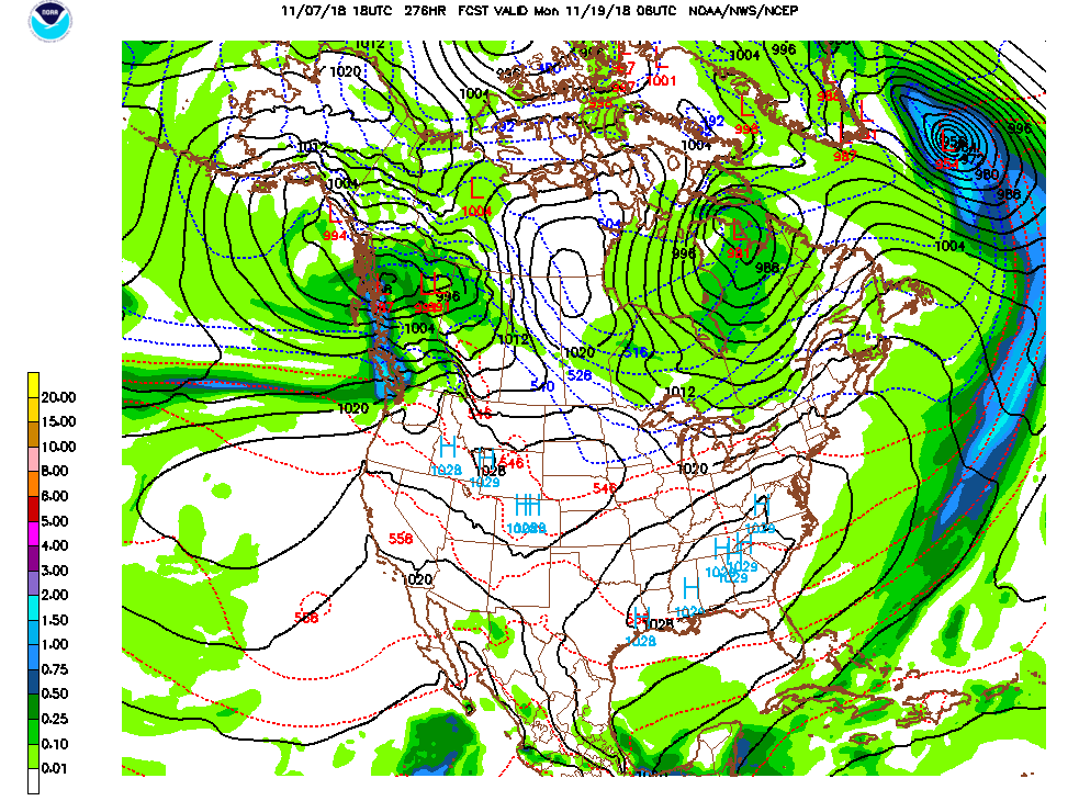
I still don’t see rain before mid-month. Here is a look at the November 19th chart. Nothing even nearby.
The key issue is the mean position of the jet stream in a ridge. This is a look at the jet position anomaly, in other words it typically is not positioned this high this time of the year. It steers storms too far away.

The very end of model runs are starting to show a pattern break around Thanksgiving. However I need to be very clear that outlooks this far out do tend to change often and when they do I change the forecast as often as necessary. Please keep in touch to see my latest thoughts.
