


The City of Paso Robles is trying to make it easier for residents to get information about road conditions and future repairs in their neighborhoods.
The new interactive street maintenance map application was developed after damage from last year's storms.
Residents now have the opportunity to check a street's pavement condition index rating, the last maintenance date, or upcoming maintenance information.
Kevin Wells, the assistant capital projects manager with the City of Paso Robles, says a Pavement Condition Index is a way to measure and rate the condition of a road or pavement on a scale from 0 to 100.
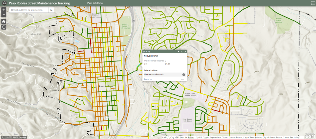
“We really wanted to be transparent with the residents and everything — with the road conditions,” said Wells. “A pavement condition index is 0 to 100. One-hundred being brand new pavement, brand new base layer. Zero being, obviously, not even road, really.”
Wells says each street in the city has been entered into the mapping system with the street’s Pavement Condition Index rating and any recent maintenance records.
“We’re going to continuously update it,” said Wells. “There are segments that don’t have history. I think the earliest date I remember is 2007.”
City leaders say the Pavement Condition Index is also a way to prioritize road work city-wide.
“It’s a complex calculation which brings in the road distress types, the quantities, and over that road segment,” Wells said. “A lot of things go into it. It could be alligator cracking. It could be environmental. It could be numerous things.”
It's one of a handful of geographic information system (GIS) interactive maps the city has invested in — each available for use by residents.
Some local residents told KSBY News that some roads in the community require immediate attention.
“I often do see cracks and really big dips in the road," said Evelida Barajas, a Paso Robles resident. "It can become dangerous at some points, especially with the rainy conditions.”
“On Niblick, there’s always parts of the road that look like they are starting to wash away," said Jessica Juniper, a Paso Robles resident. "I do feel like that could be worked on.”
A step-by-step guide on how to use the new interactive street maintenance map is available online.
